San Miguel Tetepelcingo geodata
San Miguel Tetepelcingo (Oaxaca) is a populated place; located in Mexico in America/Mexico_City (GMT-6) time zone. With population of 1,738 people, there are 4991 cities with bigger population in this country. Compared to other cities in Mexico, 95% of cities are located further ↑North; 64.8% of cities are located further ←West and 74.7% of cities have higher elevation than San Miguel Tetepelcingo. Note1
Current local time in San Miguel Tetepelcingo:
09:05 AM, MondayDifference from your time zone: hours


San Miguel Tetepelcingo GPS coordinates[2]
16° 23' 52.404" North, 97° 54' 4.572" West
| Map corner | latitude | longitude |
|---|---|---|
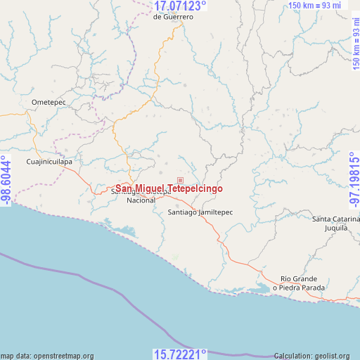
| Upper-left | 17.07123°, | -98.6044° |
| Center: | 16.39789°, | -97.90127° |
| Lower-right: | 15.72221°, | -97.19815° |
| Map W x H: | 150×150 km | = 93.2×93.2mi |
| max Lat: | 32.7° ⇑95% North |
| San Miguel Tetepelcingo: | 16.39789° |
| min Lat: | ⇓5% South 14.53588° |
| min Long | San Miguel Tete | max Long |
| -117.105° | -97.90127° | -86.73105° |
| W 64.8%⇐ | ⇒35.2% E |
Elevation
Elevation of San Miguel Tetepelcingo is 230 m = 755 ft, and this is 1023.7 m = 3359 ft below average elevation for this country.
| Max E: |
3497 m = 11473 ft | 74.7% |
| Avg. | 1253.7 m = 4113 ft | |
| San Miguel Tetepelcingo | 230 m = 755 ft | |
Min E: |
-1 m = -3 ft | 25.3% |
See also: Mexico elevation on elevation.city.
Geographical zone
San Miguel Tetepelcingo is located in North Torrid zone (between Equator and Tropic of Cancer). Distance of this Northern Tropic circle is 782.6 km =486.3 mi to North.| Distance of | km | miles | from San Miguel Tetepelcingo |
|---|---|---|---|
| North Pole | 8183.8 | 5085.2 | to North |
| Arctic Circle | 5577.9 | 3465.9 | to North |
| Tropic Cancer | 782.6 | 486.3 | to North |
| Equator | 1823.3 | 1132.9 | to South |


Nearby cities:
15 places around San Miguel Tetepelcingo: (largest is in red/bold)
• Cubitán de Dolores
4.4 km =2.7 mi,  165°
165°
• La Muralla
12.3 km =7.6 mi,  31°
31°
• Pinotepa de Don Luis
8.7 km =5.4 mi,  292°
292°
• Rancho Viejo
9.3 km =5.8 mi,  225°
225°
• San Agustín Chayuco
9.9 km =6.2 mi,  87°
87°
• San Andrés Huaxpaltepec
7.8 km =4.8 mi,  192°
192°
• San Cristóbal
10.3 km =6.4 mi,  21°
21°
• San Juan Colorado
9 km =5.6 mi,  320°
320°
• San Juan Yosocani
4 km =2.5 mi,  1°
1°
• San Lorenzo
2.9 km =1.8 mi,  96°
96°
• Santa Catarina Mechoacán
9.7 km =6 mi,  135°
135°
• Santa María Huazolotitlán
10.6 km =6.6 mi, 186°
• Santa María Nutío
9.7 km =6 mi,  358°
358°
• Santa María Yosocani
4.9 km =3 mi,  44°
44°
• Siniyuvi
9.1 km =5.7 mi,  342°
342°
Sources, notices
• [Note1] Compared only with cities in Mexico existing in our database
• [Src1] Map data: © OpenStreetMap contributors (CC-BY-SA)
• [Src2] Other city data from geonames.org with taken over terms of usage.
• [Src3] Geographical zone / Annual Mean Temperature by Robert A. Rohde @ Wikipedia
