San Juan Yosocani geodata
San Juan Yosocani (Oaxaca) is a populated place; located in Mexico in America/Mexico_City (GMT-6) time zone. With population of 504 people, there are 16693 cities with bigger population in this country. Compared to other cities in Mexico, 94.8% of cities are located further ↑North; 64.8% of cities are located further ←West and 68.1% of cities have higher elevation than San Juan Yosocani. Note1


San Juan Yosocani GPS coordinates[2]
16° 26' 2.724" North, 97° 54' 1.8" West
| Map corner | latitude | longitude |
|---|---|---|
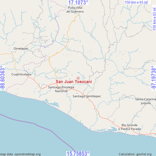
| Upper-left | 17.1073°, | -98.60363° |
| Center: | 16.43409°, | -97.9005° |
| Lower-right: | 15.75853°, | -97.19738° |
| Map W x H: | 150×150 km | = 93.2×93.2mi |
| max Lat: | 32.7° ⇑94.8% North |
| San Juan Yosocani: | 16.43409° |
| min Lat: | ⇓5.2% South 14.53588° |
| min Long | San Juan Yosoca | max Long |
| -117.105° | -97.9005° | -86.73105° |
| W 64.8%⇐ | ⇒35.2% E |
Elevation
Elevation of San Juan Yosocani is 523 m = 1716 ft, and this is 730.7 m = 2397 ft below average elevation for this country.
| Max E: |
3497 m = 11473 ft | 68.1% |
| Avg. | 1253.7 m = 4113 ft | |
| San Juan Yosocani | 523 m = 1716 ft | |
Min E: |
-1 m = -3 ft | 31.9% |
See also: Mexico elevation on elevation.city.
Geographical zone
San Juan Yosocani is located in North Torrid zone (between Equator and Tropic of Cancer). Distance of this Northern Tropic circle is 778.6 km =483.8 mi to North.| Distance of | km | miles | from San Juan Yosocani |
|---|---|---|---|
| North Pole | 8179.8 | 5082.7 | to North |
| Arctic Circle | 5573.9 | 3463.5 | to North |
| Tropic Cancer | 778.6 | 483.8 | to North |
| Equator | 1827.3 | 1135.4 | to South |


Nearby cities:
15 places around San Juan Yosocani: (largest is in red/bold)
• Cubitán de Dolores
8.3 km =5.2 mi,  173°
173°
• La Muralla
9.1 km =5.7 mi,  44°
44°
• Nuevo Progreso
9.7 km =6 mi,  4°
4°
• Pinotepa de Don Luis
8.2 km =5.1 mi,  264°
264°
• San Agustín Chayuco
10.5 km =6.5 mi,  109°
109°
• San Andrés Huaxpaltepec
11.8 km =7.3 mi,  188°
188°
• San Cristóbal
6.7 km =4.2 mi,  33°
33°
• San Juan Colorado
6.5 km =4 mi,  297°
297°
• San Lorenzo
5.2 km =3.2 mi,  147°
147°
• San Miguel Tetepelcingo
4 km =2.5 mi,  181°
181°
• San Pedro Atoyac
11 km =6.8 mi, 304°
• San Pedro Jicayán
12.3 km =7.6 mi,  279°
279°
• Santa María Nutío
5.7 km =3.5 mi,  356°
356°
• Santa María Yosocani
3.4 km =2.1 mi,  98°
98°
• Siniyuvi
5.5 km =3.4 mi,  328°
328°
Sources, notices
• [Note1] Compared only with cities in Mexico existing in our database
• [Src1] Map data: © OpenStreetMap contributors (CC-BY-SA)
• [Src2] Other city data from geonames.org with taken over terms of usage.
• [Src3] Geographical zone / Annual Mean Temperature by Robert A. Rohde @ Wikipedia
