Ildefonso Turrubiartes (La Boquilla) geodata
Ildefonso Turrubiartes (La Boquilla) (San Luis Potosí) is a populated place; located in Mexico in America/Mexico_City (GMT-6) time zone. With population of 527 people, there are 16037 cities with bigger population in this country. Compared to other cities in Mexico, 83.7% of cities are located further ↓South; 62.3% of cities are located further →East and 59.5% of cities have higher elevation than Ildefonso Turrubiartes (La Boquilla). Note1
Current local time in Ildefonso Turrubiartes (La Boquilla):
06:50 AM, WednesdayDifference from your time zone: hours


Ildefonso Turrubiartes (La Boquilla) GPS coordinates[2]
21° 55' 35.004" North, 99° 52' 8.004" West
| Map corner | latitude | longitude |
|---|---|---|
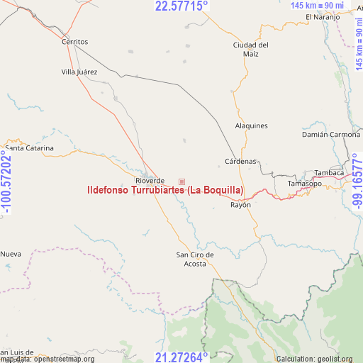
| Upper-left | 22.57715°, | -100.57202° |
| Center: | 21.92639°, | -99.86889° |
| Lower-right: | 21.27264°, | -99.16577° |
| Map W x H: | 145×145 km | = 90.1×90.1mi |
| max Lat: | 32.7° ⇑16.3% North |
| Ildefonso Turrubiartes (La Boquilla): | 21.92639° |
| min Lat: | ⇓83.7% South 14.53588° |
| min Long | Ildefonso Turru | max Long |
| -117.105° | -99.86889° | -86.73105° |
| W 37.7%⇐ | ⇒62.3% E |
Elevation
Elevation of Ildefonso Turrubiartes (La Boquilla) is 1025 m = 3363 ft, and this is 228.7 m = 750 ft below average elevation for this country.
| Max E: |
3497 m = 11473 ft | 59.5% |
| Avg. | 1253.7 m = 4113 ft | |
| Ildefonso Turrubiartes (La Boquilla) | 1025 m = 3363 ft | |
Min E: |
-1 m = -3 ft | 40.5% |
See also: Mexico elevation on elevation.city.
Geographical zone
Ildefonso Turrubiartes (La Boquilla) is located in North Torrid zone (between Equator and Tropic of Cancer). Distance of this Northern Tropic circle is 167.9 km =104.3 mi to North.| Distance of | km | miles | from Ildefonso Turrubiartes (La Boquilla) |
|---|---|---|---|
| North Pole | 7569.1 | 4703.2 | to North |
| Arctic Circle | 4963.2 | 3084 | to North |
| Tropic Cancer | 167.9 | 104.3 | to North |
| Equator | 2438 | 1514.9 | to South |


Nearby cities:
15 places around Ildefonso Turrubiartes (La Boquilla): (largest is in red/bold)
• Barrio de Guadalupe
19.2 km =11.9 mi,  287°
287°
• Cerrito de la Cruz
16.7 km =10.4 mi,  103°
103°
• Ciudad Fernández
14.8 km =9.2 mi,  276°
276°
• Colonia Veinte de Noviembre
19.6 km =12.2 mi, 287°
• El Capulín
20.5 km =12.7 mi,  237°
237°
• El Jabalí
19.6 km =12.2 mi,  256°
256°
• Las Adjuntas
19.7 km =12.2 mi, 281°
• Las Magdalenas
13.1 km =8.1 mi,  224°
224°
• Miguel Hidalgo
5.4 km =3.4 mi, 220°
• Plazuela
15.6 km =9.7 mi,  204°
204°
• Rioverde
13 km =8.1 mi,  272°
272°
• San Francisco
16.5 km =10.3 mi,  3°
3°
• San José del Tapanco
17.8 km =11.1 mi,  193°
193°
• San Vicente
11.8 km =7.3 mi,  67°
67°
• Santa Rita
6.7 km =4.2 mi,  22°
22°
Sources, notices
• [Note1] Compared only with cities in Mexico existing in our database
• [Src1] Map data: © OpenStreetMap contributors (CC-BY-SA)
• [Src2] Other city data from geonames.org with taken over terms of usage.
• [Src3] Geographical zone / Annual Mean Temperature by Robert A. Rohde @ Wikipedia
