Plan de las Hayas geodata
Plan de las Hayas (Veracruz) is a populated place; located in Mexico in America/Mexico_City (GMT-6) time zone. With population of 2,199 people, there are 3993 cities with bigger population in this country. Compared to other cities in Mexico, 51.7% of cities are located further ↓South; 78.6% of cities are located further ←West and 58.9% of cities have higher elevation than Plan de las Hayas. Note1


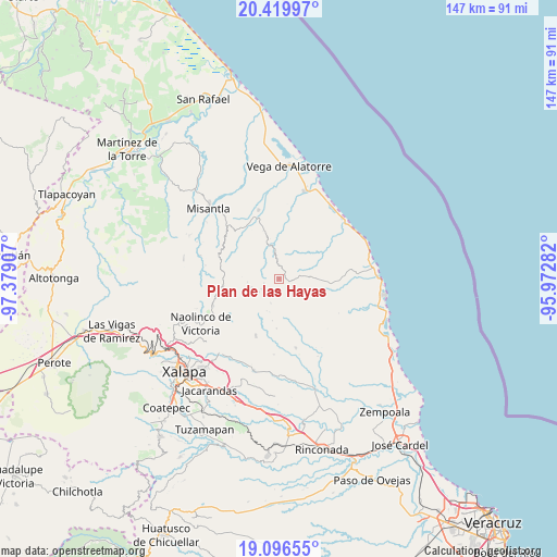
Plan de las Hayas GPS coordinates[2]
19° 45' 34.668" North, 96° 40' 33.384" West
| Map corner | latitude | longitude |
|---|---|---|
| Upper-left | 20.41997°, | -97.37907° |
| Center: | 19.75963°, | -96.67594° |
| Lower-right: | 19.09655°, | -95.97282° |
| Map W x H: | 147.2×147.2 km | = 91.5×91.5mi |
| max Lat: | 32.7° ⇑48.3% North |
| Plan de las Hayas: | 19.75963° |
| min Lat: | ⇓51.7% South 14.53588° |
| min Long | Plan de las Hay | max Long |
| -117.105° | -96.67594° | -86.73105° |
| W 78.6%⇐ | ⇒21.4% E |
Elevation
Elevation of Plan de las Hayas is 1057 m = 3468 ft, and this is 196.7 m = 645 ft below average elevation for this country.
| Max E: |
3497 m = 11473 ft | 58.9% |
| Avg. | 1253.7 m = 4113 ft | |
| Plan de las Hayas | 1057 m = 3468 ft | |
Min E: |
-1 m = -3 ft | 41.1% |
See also: Mexico elevation on elevation.city.
Geographical zone
Plan de las Hayas is located in North Torrid zone (between Equator and Tropic of Cancer). Distance of this Northern Tropic circle is 408.9 km =254.1 mi to North.| Distance of | km | miles | from Plan de las Hayas |
|---|---|---|---|
| North Pole | 7810 | 4852.9 | to North |
| Arctic Circle | 5204.1 | 3233.7 | to North |
| Tropic Cancer | 408.9 | 254.1 | to North |
| Equator | 2197.1 | 1365.2 | to South |


Nearby cities:
15 places around Plan de las Hayas: (largest is in red/bold)
• Cuautitlán del Parral
11.1 km =6.9 mi,  328°
328°
• Dos Arroyos
12.4 km =7.7 mi,  344°
344°
• El Cafetal
8.9 km =5.5 mi,  201°
201°
• El Capulín
5.3 km =3.3 mi,  241°
241°
• El Chaparral
12.7 km =7.9 mi,  11°
11°
• El Escalanar
6.2 km =3.9 mi, 237°
• El Huérfano
7.6 km =4.7 mi,  253°
253°
• Enríquez
11.4 km =7.1 mi,  218°
218°
• Juchique de Ferrer
9.1 km =5.7 mi,  347°
347°
• La Sombra
4.1 km =2.5 mi,  256°
256°
• Laguna de Farfán
5.9 km =3.7 mi,  34°
34°
• Monte Verde Chivería
6.6 km =4.1 mi, 198°
• Rancho Nuevo
3.3 km =2.1 mi,  176°
176°
• Tierra Blanca
4.4 km =2.7 mi, 178°
• Xomotla
10.4 km =6.5 mi,  208°
208°
Sources, notices
• [Note1] Compared only with cities in Mexico existing in our database
• [Src1] Map data: © OpenStreetMap contributors (CC-BY-SA)
• [Src2] Other city data from geonames.org with taken over terms of usage.
• [Src3] Geographical zone / Annual Mean Temperature by Robert A. Rohde @ Wikipedia
