El Chaparral geodata
El Chaparral (Veracruz) is a populated place; located in Mexico in America/Mexico_City (GMT-6) time zone. With population of 716 people, there are 12166 cities with bigger population in this country. Compared to other cities in Mexico, 54.5% of cities are located further ↓South; 78.8% of cities are located further ←West and 74.8% of cities have higher elevation than El Chaparral. Note1


El Chaparral GPS coordinates[2]
19° 52' 16.392" North, 96° 39' 3.168" West
| Map corner | latitude | longitude |
|---|---|---|
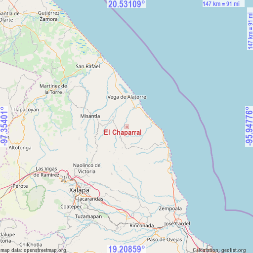
| Upper-left | 20.53109°, | -97.35401° |
| Center: | 19.87122°, | -96.65088° |
| Lower-right: | 19.20859°, | -95.94776° |
| Map W x H: | 147×147.1 km | = 91.3×91.4mi |
| max Lat: | 32.7° ⇑45.5% North |
| El Chaparral: | 19.87122° |
| min Lat: | ⇓54.5% South 14.53588° |
| min Long | El Chaparral | max Long |
| -117.105° | -96.65088° | -86.73105° |
| W 78.8%⇐ | ⇒21.2% E |
Elevation
Elevation of El Chaparral is 229 m = 751 ft, and this is 1024.7 m = 3362 ft below average elevation for this country.
| Max E: |
3497 m = 11473 ft | 74.8% |
| Avg. | 1253.7 m = 4113 ft | |
| El Chaparral | 229 m = 751 ft | |
Min E: |
-1 m = -3 ft | 25.2% |
See also: Mexico elevation on elevation.city.
Geographical zone
El Chaparral is located in North Torrid zone (between Equator and Tropic of Cancer). Distance of this Northern Tropic circle is 396.4 km =246.3 mi to North.| Distance of | km | miles | from El Chaparral |
|---|---|---|---|
| North Pole | 7797.6 | 4845.2 | to North |
| Arctic Circle | 5191.7 | 3226 | to North |
| Tropic Cancer | 396.4 | 246.3 | to North |
| Equator | 2209.5 | 1372.9 | to South |


Nearby cities:
15 places around El Chaparral: (largest is in red/bold)
• Arroyo Frío
15.8 km =9.8 mi,  310°
310°
• Colipa
9.8 km =6.1 mi, 305°
• Cristóbal Hidalgo
11.4 km =7.1 mi,  258°
258°
• Cuautitlán del Parral
9 km =5.6 mi,  250°
250°
• Dos Arroyos
6 km =3.7 mi,  265°
265°
• El Capulín
16.6 km =10.3 mi,  205°
205°
• Juchique de Ferrer
5.8 km =3.6 mi,  232°
232°
• La Sombra
14.9 km =9.3 mi, 206°
• Laguna de Farfán
7.6 km =4.7 mi,  174°
174°
• Leona Vicario
15.8 km =9.8 mi, 263°
• Plan de las Hayas
12.7 km =7.9 mi,  191°
191°
• Rancho Nuevo
15.9 km =9.9 mi, 188°
• Santa Ana
15.2 km =9.4 mi,  81°
81°
• Villa Emilio Carranza
11.7 km =7.3 mi,  20°
20°
• Yecuatla
13.3 km =8.3 mi, 267°
Sources, notices
• [Note1] Compared only with cities in Mexico existing in our database
• [Src1] Map data: © OpenStreetMap contributors (CC-BY-SA)
• [Src2] Other city data from geonames.org with taken over terms of usage.
• [Src3] Geographical zone / Annual Mean Temperature by Robert A. Rohde @ Wikipedia
