El Capulín geodata
El Capulín (Veracruz) is a populated place; located in Mexico in America/Mexico_City (GMT-6) time zone. With population of 819 people, there are 10664 cities with bigger population in this country. Compared to other cities in Mexico, 51.3% of cities are located further ↓South; 78.2% of cities are located further ←West and 53.1% of cities have higher elevation than El Capulín. Note1


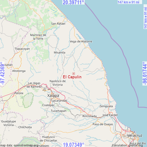
El Capulín GPS coordinates[2]
19° 44' 12.012" North, 96° 43' 14.016" West
| Map corner | latitude | longitude |
|---|---|---|
| Upper-left | 20.39711°, | -97.42369° |
| Center: | 19.73667°, | -96.72056° |
| Lower-right: | 19.07349°, | -96.01744° |
| Map W x H: | 147.2×147.2 km | = 91.5×91.5mi |
| max Lat: | 32.7° ⇑48.7% North |
| El Capulín: | 19.73667° |
| min Lat: | ⇓51.3% South 14.53588° |
| min Long | El Capulín | max Long |
| -117.105° | -96.72056° | -86.73105° |
| W 78.2%⇐ | ⇒21.8% E |
Elevation
Elevation of El Capulín is 1288 m = 4226 ft, and this is 34.3 m = 113 ft above average elevation for this country.
| Max E: |
3497 m = 11473 ft | 53.1% |
| El Capulín | 1288 m 4226 ft | |
| Avg. | 1253.7 m = 4113 ft | |
Min E: |
-1 m = -3 ft | 46.9% |
See also: Mexico elevation on elevation.city.
Geographical zone
El Capulín is located in North Torrid zone (between Equator and Tropic of Cancer). Distance of this Northern Tropic circle is 411.4 km =255.6 mi to North.| Distance of | km | miles | from El Capulín |
|---|---|---|---|
| North Pole | 7812.5 | 4854.5 | to North |
| Arctic Circle | 5206.7 | 3235.3 | to North |
| Tropic Cancer | 411.4 | 255.6 | to North |
| Equator | 2194.5 | 1363.6 | to South |


Nearby cities:
15 places around El Capulín: (largest is in red/bold)
• Chiconquiaco
10.3 km =6.4 mi,  273°
273°
• El Cafetal
5.9 km =3.7 mi,  165°
165°
• El Escalanar
0.9 km =0.6 mi,  214°
214°
• El Huérfano
2.6 km =1.6 mi,  280°
280°
• Enríquez
6.8 km =4.2 mi,  200°
200°
• Juchique de Ferrer
11.8 km =7.3 mi,  13°
13°
• La Sombra
1.7 km =1.1 mi,  23°
23°
• Laguna de Farfán
10.9 km =6.8 mi,  47°
47°
• Mafafas
9.4 km =5.8 mi, 203°
• Monte Verde Chivería
4.5 km =2.8 mi,  145°
145°
• Plan de las Hayas
5.3 km =3.3 mi,  61°
61°
• Rancho Nuevo
4.9 km =3 mi,  98°
98°
• Tepetlán
10.7 km =6.6 mi,  228°
228°
• Tierra Blanca
5.1 km =3.2 mi,  111°
111°
• Xomotla
6.6 km =4.1 mi,  182°
182°
Sources, notices
• [Note1] Compared only with cities in Mexico existing in our database
• [Src1] Map data: © OpenStreetMap contributors (CC-BY-SA)
• [Src2] Other city data from geonames.org with taken over terms of usage.
• [Src3] Geographical zone / Annual Mean Temperature by Robert A. Rohde @ Wikipedia
