La Guásima geodata
La Guásima (Veracruz) is a populated place; located in Mexico in America/Mexico_City (GMT-6) time zone. With population of 567 people, there are 15067 cities with bigger population in this country. Compared to other cities in Mexico, 78.1% of cities are located further ↓South; 65.6% of cities are located further ←West and 72.5% of cities have higher elevation than La Guásima. Note1


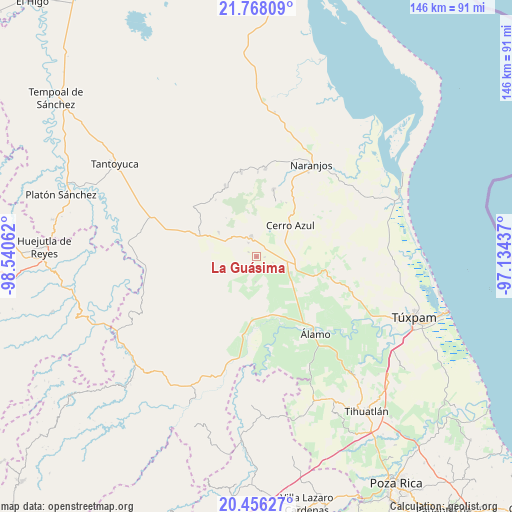
La Guásima GPS coordinates[2]
21° 6' 49.068" North, 97° 50' 14.964" West
| Map corner | latitude | longitude |
|---|---|---|
| Upper-left | 21.76809°, | -98.54062° |
| Center: | 21.11363°, | -97.83749° |
| Lower-right: | 20.45627°, | -97.13437° |
| Map W x H: | 145.9×145.9 km | = 90.7×90.7mi |
| max Lat: | 32.7° ⇑21.9% North |
| La Guásima: | 21.11363° |
| min Lat: | ⇓78.1% South 14.53588° |
| min Long | La Guásima | max Long |
| -117.105° | -97.83749° | -86.73105° |
| W 65.6%⇐ | ⇒34.4% E |
Elevation
Elevation of La Guásima is 313 m = 1027 ft, and this is 940.7 m = 3086 ft below average elevation for this country.
| Max E: |
3497 m = 11473 ft | 72.5% |
| Avg. | 1253.7 m = 4113 ft | |
| La Guásima | 313 m = 1027 ft | |
Min E: |
-1 m = -3 ft | 27.5% |
See also: Mexico elevation on elevation.city.
Geographical zone
La Guásima is located in North Torrid zone (between Equator and Tropic of Cancer). Distance of this Northern Tropic circle is 258.3 km =160.5 mi to North.| Distance of | km | miles | from La Guásima |
|---|---|---|---|
| North Pole | 7659.4 | 4759.3 | to North |
| Arctic Circle | 5053.6 | 3140.2 | to North |
| Tropic Cancer | 258.3 | 160.5 | to North |
| Equator | 2347.6 | 1458.7 | to South |


Nearby cities:
15 places around La Guásima: (largest is in red/bold)
• Cerro Azul
13.3 km =8.3 mi,  48°
48°
• Copaltitla
8.8 km =5.5 mi,  334°
334°
• El Humo
12.8 km =8 mi,  302°
302°
• El Mirador
15.8 km =9.8 mi,  224°
224°
• Francia Nueva
12 km =7.5 mi,  271°
271°
• Horcones
10.8 km =6.7 mi,  115°
115°
• Juan Felipe
8.5 km =5.3 mi,  57°
57°
• Monte Chiquito
17.2 km =10.7 mi,  167°
167°
• Piedra Labrada
10.1 km =6.3 mi,  26°
26°
• Potrero del Llano
12 km =7.5 mi,  108°
108°
• Tecomate
4.6 km =2.9 mi, 329°
• Tepetzintla
5.8 km =3.6 mi,  344°
344°
• Tierra Blanca
10 km =6.2 mi, 300°
• Tlacolula
12.9 km =8 mi,  259°
259°
• Zapotitlán
2.4 km =1.5 mi,  92°
92°
Sources, notices
• [Note1] Compared only with cities in Mexico existing in our database
• [Src1] Map data: © OpenStreetMap contributors (CC-BY-SA)
• [Src2] Other city data from geonames.org with taken over terms of usage.
• [Src3] Geographical zone / Annual Mean Temperature by Robert A. Rohde @ Wikipedia
