Palpoalanixcan geodata
Palpoalanixcan (Veracruz) is a populated place; located in Mexico in America/Mexico_City (GMT-6) time zone. With population of 627 people, there are 13802 cities with bigger population in this country. Compared to other cities in Mexico, 58.5% of cities are located further ↓South; 75.5% of cities are located further ←West and 83.3% of cities have higher elevation than Palpoalanixcan. Note1


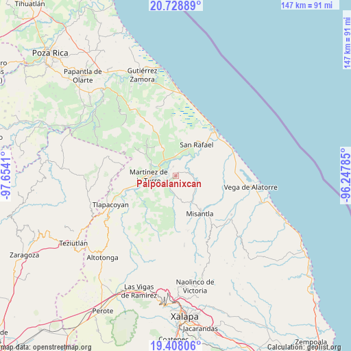
Palpoalanixcan GPS coordinates[2]
20° 4' 11.532" North, 96° 57' 3.492" West
| Map corner | latitude | longitude |
|---|---|---|
| Upper-left | 20.72889°, | -97.6541° |
| Center: | 20.06987°, | -96.95097° |
| Lower-right: | 19.40806°, | -96.24785° |
| Map W x H: | 146.9×146.9 km | = 91.3×91.3mi |
| max Lat: | 32.7° ⇑41.5% North |
| Palpoalanixcan: | 20.06987° |
| min Lat: | ⇓58.5% South 14.53588° |
| min Long | Palpoalanixcan | max Long |
| -117.105° | -96.95097° | -86.73105° |
| W 75.5%⇐ | ⇒24.5% E |
Elevation
Elevation of Palpoalanixcan is 58 m = 190 ft, and this is 1195.7 m = 3923 ft below average elevation for this country.
| Max E: |
3497 m = 11473 ft | 83.3% |
| Avg. | 1253.7 m = 4113 ft | |
| Palpoalanixcan | 58 m = 190 ft | |
Min E: |
-1 m = -3 ft | 16.7% |
See also: Mexico elevation on elevation.city.
Geographical zone
Palpoalanixcan is located in North Torrid zone (between Equator and Tropic of Cancer). Distance of this Northern Tropic circle is 374.4 km =232.6 mi to North.| Distance of | km | miles | from Palpoalanixcan |
|---|---|---|---|
| North Pole | 7775.5 | 4831.5 | to North |
| Arctic Circle | 5169.6 | 3212.2 | to North |
| Tropic Cancer | 374.4 | 232.6 | to North |
| Equator | 2231.6 | 1386.7 | to South |


Nearby cities:
15 places around Palpoalanixcan: (largest is in red/bold)
• Coapeche
5.4 km =3.4 mi,  71°
71°
• El Progreso
8.3 km =5.2 mi,  306°
306°
• Felipe Carrillo Puerto
7.3 km =4.5 mi,  359°
359°
• Francisco Sarabia
6.1 km =3.8 mi,  200°
200°
• La Colmena
5.4 km =3.4 mi,  281°
281°
• La Defensa
4 km =2.5 mi,  345°
345°
• La Isla de Chapachapa
9.2 km =5.7 mi,  51°
51°
• La Libertad
2.9 km =1.8 mi,  231°
231°
• La Piedrilla
7 km =4.3 mi,  296°
296°
• La Reforma
7 km =4.3 mi,  21°
21°
• María de la Torre
8.1 km =5 mi,  324°
324°
• Máximo García
3.3 km =2.1 mi, 324°
• Plan de Limón
4.2 km =2.6 mi,  243°
243°
• Pueblo Viejo Dos
7.5 km =4.7 mi,  257°
257°
• Villanueva
7.1 km =4.4 mi,  290°
290°
Sources, notices
• [Note1] Compared only with cities in Mexico existing in our database
• [Src1] Map data: © OpenStreetMap contributors (CC-BY-SA)
• [Src2] Other city data from geonames.org with taken over terms of usage.
• [Src3] Geographical zone / Annual Mean Temperature by Robert A. Rohde @ Wikipedia
