Jesús Nazareno geodata
Jesús Nazareno (Puebla) is a populated place; located in Mexico in America/Mexico_City (GMT-6) time zone. With population of 2,821 people, there are 3144 cities with bigger population in this country. Compared to other cities in Mexico, 67.6% of cities are located further ↑North; 68.2% of cities are located further ←West and 81.2% of cities have lower elevation than Jesús Nazareno. Note1


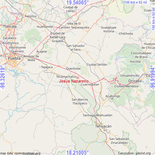
Jesús Nazareno GPS coordinates[2]
18° 52' 36.012" North, 97° 37' 23.016" West
| Map corner | latitude | longitude |
|---|---|---|
| Upper-left | 19.54065°, | -98.32619° |
| Center: | 18.87667°, | -97.62306° |
| Lower-right: | 18.21005°, | -96.91994° |
| Map W x H: | 147.9×148 km | = 91.9×92mi |
| max Lat: | 32.7° ⇑67.6% North |
| Jesús Nazareno: | 18.87667° |
| min Lat: | ⇓32.4% South 14.53588° |
| min Long | Jesús Nazareno | max Long |
| -117.105° | -97.62306° | -86.73105° |
| W 68.2%⇐ | ⇒31.8% E |
Elevation
Elevation of Jesús Nazareno is 2169 m = 7116 ft, and this is 915.3 m = 3003 ft above average elevation for this country.
| Max E: |
3497 m = 11473 ft | 18.8% |
| Jesús Nazareno | 2169 m 7116 ft | |
| Avg. | 1253.7 m = 4113 ft | |
Min E: |
-1 m = -3 ft | 81.2% |
See also: Mexico elevation on elevation.city.
Geographical zone
Jesús Nazareno is located in North Torrid zone (between Equator and Tropic of Cancer). Distance of this Northern Tropic circle is 507 km =315 mi to North.| Distance of | km | miles | from Jesús Nazareno |
|---|---|---|---|
| North Pole | 7908.2 | 4913.9 | to North |
| Arctic Circle | 5302.3 | 3294.7 | to North |
| Tropic Cancer | 507 | 315 | to North |
| Equator | 2098.9 | 1304.2 | to South |


Nearby cities:
15 places around Jesús Nazareno: (largest is in red/bold)
• Bellavista de Victoria (San José Bellavista)
8.3 km =5.2 mi,  90°
90°
• Francisco I. Madero
8.7 km =5.4 mi,  313°
313°
• Guadalupe Enríquez
4.2 km =2.6 mi,  63°
63°
• La Purísima
7.4 km =4.6 mi,  134°
134°
• Palmar de Bravo
9.2 km =5.7 mi,  119°
119°
• Palmarito Tochapan
3.2 km =2 mi,  329°
329°
• Quecholac
9.4 km =5.8 mi,  336°
336°
• San Bartolomé
4.6 km =2.9 mi,  5°
5°
• San Cayetano
5 km =3.1 mi,  348°
348°
• San Isidro Monterrosas
5.5 km =3.4 mi,  113°
113°
• Santa Cruz Monterrosas
6.4 km =4 mi, 90°
• Santiago Alseseca
9.5 km =5.9 mi,  248°
248°
• Tuzuapan
5.4 km =3.4 mi,  300°
300°
• Xaltepec
1.7 km =1.1 mi,  70°
70°
• Yehualtepec
9.9 km =6.2 mi,  204°
204°
Sources, notices
• [Note1] Compared only with cities in Mexico existing in our database
• [Src1] Map data: © OpenStreetMap contributors (CC-BY-SA)
• [Src2] Other city data from geonames.org with taken over terms of usage.
• [Src3] Geographical zone / Annual Mean Temperature by Robert A. Rohde @ Wikipedia
