Pablo L. Sidar geodata
Pablo L. Sidar (Chiapas) is a populated place; located in Mexico in America/Mexico_City (GMT-6) time zone. With population of 3,070 people, there are 2935 cities with bigger population in this country. Compared to other cities in Mexico, 97.7% of cities are located further ↑North; 93.5% of cities are located further ←West and 66.3% of cities have higher elevation than Pablo L. Sidar. Note1


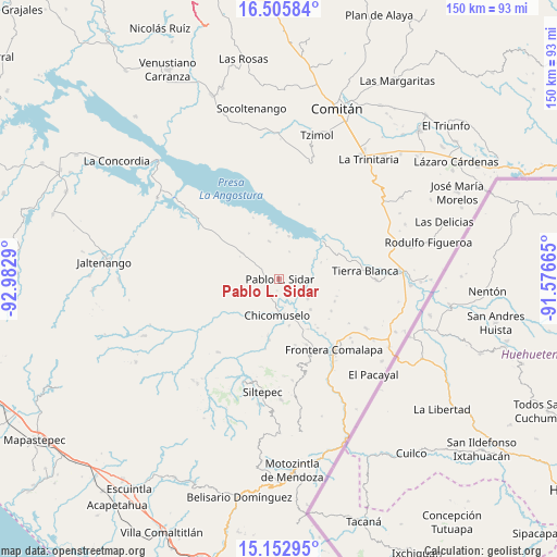
Pablo L. Sidar GPS coordinates[2]
15° 49' 49.908" North, 92° 16' 47.172" West
| Map corner | latitude | longitude |
|---|---|---|
| Upper-left | 16.50584°, | -92.9829° |
| Center: | 15.83053°, | -92.27977° |
| Lower-right: | 15.15295°, | -91.57665° |
| Map W x H: | 150.4×150.4 km | = 93.5×93.5mi |
| max Lat: | 32.7° ⇑97.7% North |
| Pablo L. Sidar: | 15.83053° |
| min Lat: | ⇓2.3% South 14.53588° |
| min Long | Pablo L. Sidar | max Long |
| -117.105° | -92.27977° | -86.73105° |
| W 93.5%⇐ | ⇒6.5% E |
Elevation
Elevation of Pablo L. Sidar is 622 m = 2041 ft, and this is 631.7 m = 2073 ft below average elevation for this country.
| Max E: |
3497 m = 11473 ft | 66.3% |
| Avg. | 1253.7 m = 4113 ft | |
| Pablo L. Sidar | 622 m = 2041 ft | |
Min E: |
-1 m = -3 ft | 33.7% |
See also: Mexico elevation on elevation.city.
Geographical zone
Pablo L. Sidar is located in North Torrid zone (between Equator and Tropic of Cancer). Distance of this Northern Tropic circle is 845.7 km =525.5 mi to North.| Distance of | km | miles | from Pablo L. Sidar |
|---|---|---|---|
| North Pole | 8246.9 | 5124.4 | to North |
| Arctic Circle | 5641 | 3505.2 | to North |
| Tropic Cancer | 845.7 | 525.5 | to North |
| Equator | 1760.2 | 1093.7 | to South |


Nearby cities:
15 places around Pablo L. Sidar: (largest is in red/bold)
• 20 de Noviembre
14.7 km =9.1 mi,  225°
225°
• Benito Juárez
8 km =5 mi,  95°
95°
• Chicomuselo
9.6 km =6 mi,  182°
182°
• Costa Rica
16.5 km =10.3 mi,  122°
122°
• Grecia
14.1 km =8.8 mi,  257°
257°
• La Reforma
15.6 km =9.7 mi,  149°
149°
• La Zacualpa
15.7 km =9.8 mi,  191°
191°
• Lázaro Cárdenas
12.9 km =8 mi,  167°
167°
• Nueva América
10.6 km =6.6 mi,  344°
344°
• Nueva Independencia
9.3 km =5.8 mi,  125°
125°
• Nueva Libertad
11.8 km =7.3 mi, 134°
• Nuevo Mazapa
16.1 km =10 mi,  112°
112°
• Nuevo Resplandor
14.9 km =9.3 mi,  351°
351°
• Puerto Rico
11.9 km =7.4 mi,  12°
12°
• Veinticuatro de Febrero
16.7 km =10.4 mi,  142°
142°
Sources, notices
• [Note1] Compared only with cities in Mexico existing in our database
• [Src1] Map data: © OpenStreetMap contributors (CC-BY-SA)
• [Src2] Other city data from geonames.org with taken over terms of usage.
• [Src3] Geographical zone / Annual Mean Temperature by Robert A. Rohde @ Wikipedia
