Grecia geodata
Grecia (Chiapas) is a populated place; located in Mexico in America/Mexico_City (GMT-6) time zone. With population of 758 people, there are 11551 cities with bigger population in this country. Compared to other cities in Mexico, 97.9% of cities are located further ↑North; 92.7% of cities are located further ←West and 50.7% of cities have lower elevation than Grecia. Note1


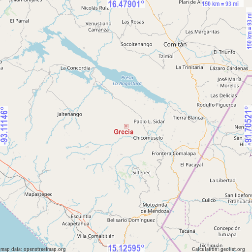
Grecia GPS coordinates[2]
15° 48' 12.996" North, 92° 24' 29.988" West
| Map corner | latitude | longitude |
|---|---|---|
| Upper-left | 16.47901°, | -93.11146° |
| Center: | 15.80361°, | -92.40833° |
| Lower-right: | 15.12595°, | -91.70521° |
| Map W x H: | 150.4×150.4 km | = 93.5×93.5mi |
| max Lat: | 32.7° ⇑97.9% North |
| Grecia: | 15.80361° |
| min Lat: | ⇓2.1% South 14.53588° |
| min Long | Grecia | max Long |
| -117.105° | -92.40833° | -86.73105° |
| W 92.7%⇐ | ⇒7.3% E |
Elevation
Elevation of Grecia is 1471 m = 4826 ft, and this is 217.3 m = 713 ft above average elevation for this country.
| Max E: |
3497 m = 11473 ft | 49.3% |
| Grecia | 1471 m 4826 ft | |
| Avg. | 1253.7 m = 4113 ft | |
Min E: |
-1 m = -3 ft | 50.7% |
See also: Mexico elevation on elevation.city.
Geographical zone
Grecia is located in North Torrid zone (between Equator and Tropic of Cancer). Distance of this Northern Tropic circle is 848.7 km =527.4 mi to North.| Distance of | km | miles | from Grecia |
|---|---|---|---|
| North Pole | 8249.9 | 5126.2 | to North |
| Arctic Circle | 5644 | 3507 | to North |
| Tropic Cancer | 848.7 | 527.4 | to North |
| Equator | 1757.2 | 1091.9 | to South |


Nearby cities:
15 places around Grecia: (largest is in red/bold)
• 20 de Noviembre
8 km =5 mi,  156°
156°
• Chicomuselo
14.9 km =9.3 mi,  116°
116°
• Guadalupe Maravillas
17.1 km =10.6 mi,  342°
342°
• La Zacualpa
16.2 km =10.1 mi,  139°
139°
• Lázaro Cárdenas
19.1 km =11.9 mi, 120°
• Miguel Alemán
12.3 km =7.6 mi,  228°
228°
• Monte Sinaí
13.5 km =8.4 mi, 160°
• Nueva América
17.2 km =10.7 mi,  39°
39°
• Nueva Morelia
6.7 km =4.2 mi,  220°
220°
• Nuevo Pacayal
18.8 km =11.7 mi,  148°
148°
• Nuevo Resplandor
21.1 km =13.1 mi,  32°
32°
• Pablo L. Sidar
14.1 km =8.8 mi,  77°
77°
• Piedra Labrada
17.4 km =10.8 mi, 140°
• Rizo de Oro
20.2 km =12.6 mi, 336°
• Unión Buenavista
14.6 km =9.1 mi,  266°
266°
Sources, notices
• [Note1] Compared only with cities in Mexico existing in our database
• [Src1] Map data: © OpenStreetMap contributors (CC-BY-SA)
• [Src2] Other city data from geonames.org with taken over terms of usage.
• [Src3] Geographical zone / Annual Mean Temperature by Robert A. Rohde @ Wikipedia
