Nueva Independencia geodata
Nueva Independencia (Chiapas) is a populated place; located in Mexico in America/Mexico_City (GMT-6) time zone. With population of 1,283 people, there are 6755 cities with bigger population in this country. Compared to other cities in Mexico, 98.2% of cities are located further ↑North; 91.3% of cities are located further ←West and 62.5% of cities have higher elevation than Nueva Independencia. Note1


Nueva Independencia GPS coordinates[2]
15° 40' 24.42" North, 92° 34' 31.656" West
| Map corner | latitude | longitude |
|---|---|---|
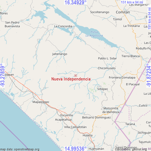
| Upper-left | 16.34929°, | -93.27859° |
| Center: | 15.67345°, | -92.57546° |
| Lower-right: | 14.99536°, | -91.87234° |
| Map W x H: | 150.5×150.5 km | = 93.5×93.5mi |
| max Lat: | 32.7° ⇑98.2% North |
| Nueva Independencia: | 15.67345° |
| min Lat: | ⇓1.8% South 14.53588° |
| min Long | Nueva Independe | max Long |
| -117.105° | -92.57546° | -86.73105° |
| W 91.3%⇐ | ⇒8.7% E |
Elevation
Elevation of Nueva Independencia is 850 m = 2789 ft, and this is 403.7 m = 1324 ft below average elevation for this country.
| Max E: |
3497 m = 11473 ft | 62.5% |
| Avg. | 1253.7 m = 4113 ft | |
| Nueva Independencia | 850 m = 2789 ft | |
Min E: |
-1 m = -3 ft | 37.5% |
See also: Mexico elevation on elevation.city.
Geographical zone
Nueva Independencia is located in North Torrid zone (between Equator and Tropic of Cancer). Distance of this Northern Tropic circle is 863.2 km =536.4 mi to North.| Distance of | km | miles | from Nueva Independencia |
|---|---|---|---|
| North Pole | 8264.3 | 5135.2 | to North |
| Arctic Circle | 5658.4 | 3516 | to North |
| Tropic Cancer | 863.2 | 536.4 | to North |
| Equator | 1742.7 | 1082.9 | to South |


Nearby cities:
15 places around Nueva Independencia: (largest is in red/bold)
• Buenos Aires
12.7 km =7.9 mi,  139°
139°
• Capitán Luis A. Vidal
9.9 km =6.2 mi,  215°
215°
• Honduras
14.1 km =8.8 mi,  131°
131°
• La Paz
13.5 km =8.4 mi,  333°
333°
• La Soledad
14.4 km =8.9 mi, 139°
• Laguna del Cofre
8.7 km =5.4 mi,  234°
234°
• Las Delicias
9 km =5.6 mi,  119°
119°
• Libertad del Pajal
14.6 km =9.1 mi,  322°
322°
• Miguel Alemán
10.7 km =6.6 mi,  54°
54°
• Montecristo
5.2 km =3.2 mi,  294°
294°
• Nueva Colombia
15.8 km =9.8 mi,  279°
279°
• Nueva Morelia
16.5 km =10.3 mi,  55°
55°
• Pablo Galeana
11.9 km =7.4 mi,  161°
161°
• San Nicolás Plan de Ayutla
6.1 km =3.8 mi, 327°
• Unión Buenavista
14 km =8.7 mi,  13°
13°
Sources, notices
• [Note1] Compared only with cities in Mexico existing in our database
• [Src1] Map data: © OpenStreetMap contributors (CC-BY-SA)
• [Src2] Other city data from geonames.org with taken over terms of usage.
• [Src3] Geographical zone / Annual Mean Temperature by Robert A. Rohde @ Wikipedia
