Las Delicias geodata
Las Delicias (Chiapas) is a populated place; located in Mexico in America/Mexico_City (GMT-6) time zone. With population of 697 people, there are 12494 cities with bigger population in this country. Compared to other cities in Mexico, 98.3% of cities are located further ↑North; 91.8% of cities are located further ←West and 62.7% of cities have higher elevation than Las Delicias. Note1


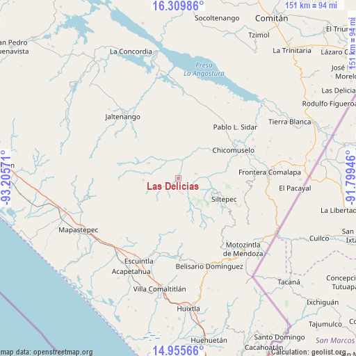
Las Delicias GPS coordinates[2]
15° 38' 1.968" North, 92° 30' 9.288" West
| Map corner | latitude | longitude |
|---|---|---|
| Upper-left | 16.30986°, | -93.20571° |
| Center: | 15.63388°, | -92.50258° |
| Lower-right: | 14.95566°, | -91.79946° |
| Map W x H: | 150.6×150.6 km | = 93.6×93.6mi |
| max Lat: | 32.7° ⇑98.3% North |
| Las Delicias: | 15.63388° |
| min Lat: | ⇓1.7% South 14.53588° |
| min Long | Las Delicias | max Long |
| -117.105° | -92.50258° | -86.73105° |
| W 91.8%⇐ | ⇒8.2% E |
Elevation
Elevation of Las Delicias is 837 m = 2746 ft, and this is 416.7 m = 1367 ft below average elevation for this country.
| Max E: |
3497 m = 11473 ft | 62.7% |
| Avg. | 1253.7 m = 4113 ft | |
| Las Delicias | 837 m = 2746 ft | |
Min E: |
-1 m = -3 ft | 37.3% |
See also: Mexico elevation on elevation.city.
Geographical zone
Las Delicias is located in North Torrid zone (between Equator and Tropic of Cancer). Distance of this Northern Tropic circle is 867.6 km =539.1 mi to North.| Distance of | km | miles | from Las Delicias |
|---|---|---|---|
| North Pole | 8268.7 | 5137.9 | to North |
| Arctic Circle | 5662.8 | 3518.7 | to North |
| Tropic Cancer | 867.6 | 539.1 | to North |
| Equator | 1738.3 | 1080.1 | to South |


Nearby cities:
15 places around Las Delicias: (largest is in red/bold)
• 20 de Noviembre
17.6 km =10.9 mi,  48°
48°
• Angel Díaz
14.2 km =8.8 mi,  131°
131°
• Buenos Aires
5.3 km =3.3 mi,  176°
176°
• Capitán Luis A. Vidal
14 km =8.7 mi,  255°
255°
• Honduras
5.7 km =3.5 mi,  150°
150°
• La Soledad
6.7 km =4.2 mi,  165°
165°
• Laguna del Cofre
14.9 km =9.3 mi,  267°
267°
• Las Moras
11.5 km =7.1 mi,  136°
136°
• Miguel Alemán
10.7 km =6.6 mi,  4°
4°
• Monte Sinaí
15.8 km =9.8 mi,  67°
67°
• Montecristo
14.2 km =8.8 mi,  297°
297°
• Nueva Independencia
9 km =5.6 mi, 299°
• Nueva Morelia
15 km =9.3 mi,  22°
22°
• Pablo Galeana
8 km =5 mi,  210°
210°
• San Nicolás Plan de Ayutla
14.6 km =9.1 mi,  310°
310°
Sources, notices
• [Note1] Compared only with cities in Mexico existing in our database
• [Src1] Map data: © OpenStreetMap contributors (CC-BY-SA)
• [Src2] Other city data from geonames.org with taken over terms of usage.
• [Src3] Geographical zone / Annual Mean Temperature by Robert A. Rohde @ Wikipedia
