Nautla geodata
Nautla (Veracruz) is a seat of a second-order administrative division; located in Mexico in America/Mexico_City (GMT-6) time zone. With population of 3,040 people, there are 2963 cities with bigger population in this country. Compared to other cities in Mexico, 61.5% of cities are located further ↓South; 77.6% of cities are located further ←West and 97.5% of cities have higher elevation than Nautla. Note1


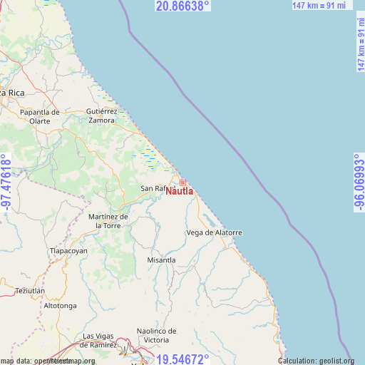
Nautla GPS coordinates[2]
20° 12' 28.62" North, 96° 46' 22.98" West
| Map corner | latitude | longitude |
|---|---|---|
| Upper-left | 20.86638°, | -97.47618° |
| Center: | 20.20795°, | -96.77305° |
| Lower-right: | 19.54672°, | -96.06993° |
| Map W x H: | 146.7×146.7 km | = 91.2×91.2mi |
| max Lat: | 32.7° ⇑38.5% North |
| Nautla: | 20.20795° |
| min Lat: | ⇓61.5% South 14.53588° |
| min Long | Nautla | max Long |
| -117.105° | -96.77305° | -86.73105° |
| W 77.6%⇐ | ⇒22.4% E |
Elevation
Elevation of Nautla is 9 m = 30 ft, and this is 1244.7 m = 4084 ft below average elevation for this country.
| Max E: |
3497 m = 11473 ft | 97.5% |
| Avg. | 1253.7 m = 4113 ft | |
| Nautla | 9 m = 30 ft | |
Min E: |
-1 m = -3 ft | 2.5% |
See also: Mexico elevation on elevation.city.
Geographical zone
Nautla is located in North Torrid zone (between Equator and Tropic of Cancer). Distance of this Northern Tropic circle is 359 km =223.1 mi to North.| Distance of | km | miles | from Nautla |
|---|---|---|---|
| North Pole | 7760.1 | 4821.9 | to North |
| Arctic Circle | 5154.3 | 3202.7 | to North |
| Tropic Cancer | 359 | 223.1 | to North |
| Equator | 2246.9 | 1396.2 | to South |


Nearby cities:
15 places around Nautla: (largest is in red/bold)
• Barra de Palmas
7 km =4.3 mi,  136°
136°
• Casitas
6 km =3.7 mi,  330°
330°
• Cementeras del Pital
13.3 km =8.3 mi,  254°
254°
• Ejido Vega de San Marcos
17.3 km =10.7 mi,  267°
267°
• El Guayabal
11.3 km =7 mi, 248°
• El Pital
14.2 km =8.8 mi, 246°
• Guadalupe Victoria
15.4 km =9.6 mi, 253°
• Insurgentes
17.2 km =10.7 mi, 252°
• Jicaltepec
9 km =5.6 mi,  241°
241°
• La Isla de Chapachapa
14.9 km =9.3 mi,  229°
229°
• La Vigueta
18 km =11.2 mi,  321°
321°
• Melchor Ocampo
5.4 km =3.4 mi,  258°
258°
• Monte Gordo
11.5 km =7.1 mi, 323°
• Puntilla Aldama
14.1 km =8.8 mi, 261°
• San Rafael
10.1 km =6.3 mi, 257°
Sources, notices
• [Note1] Compared only with cities in Mexico existing in our database
• [Src1] Map data: © OpenStreetMap contributors (CC-BY-SA)
• [Src2] Other city data from geonames.org with taken over terms of usage.
• [Src3] Geographical zone / Annual Mean Temperature by Robert A. Rohde @ Wikipedia
