Mayapan geodata
Mayapan (Yucatán) is a populated place; located in Mexico in America/Merida (GMT-6) time zone. With population of 3,263 people, there are 2780 cities with bigger population in this country. Compared to other cities in Mexico, 67.1% of cities are located further ↓South; 98.5% of cities are located further ←West and 90% of cities have higher elevation than Mayapan. Note1


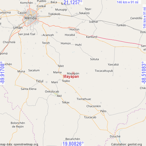
Mayapan GPS coordinates[2]
20° 28' 6.204" North, 89° 12' 50.22" West
| Map corner | latitude | longitude |
|---|---|---|
| Upper-left | 21.1257°, | -89.91708° |
| Center: | 20.46839°, | -89.21395° |
| Lower-right: | 19.80826°, | -88.51083° |
| Map W x H: | 146.5×146.5 km | = 91×91mi |
| max Lat: | 32.7° ⇑32.9% North |
| Mayapan: | 20.46839° |
| min Lat: | ⇓67.1% South 14.53588° |
| min Long | Mayapan | max Long |
| -117.105° | -89.21395° | -86.73105° |
| W 98.5%⇐ | ⇒1.5% E |
Elevation
Elevation of Mayapan is 24 m = 79 ft, and this is 1229.7 m = 4034 ft below average elevation for this country.
| Max E: |
3497 m = 11473 ft | 90% |
| Avg. | 1253.7 m = 4113 ft | |
| Mayapan | 24 m = 79 ft | |
Min E: |
-1 m = -3 ft | 10% |
See also: Mexico elevation on elevation.city.
Geographical zone
Mayapan is located in North Torrid zone (between Equator and Tropic of Cancer). Distance of this Northern Tropic circle is 330 km =205.1 mi to North.| Distance of | km | miles | from Mayapan |
|---|---|---|---|
| North Pole | 7731.2 | 4803.9 | to North |
| Arctic Circle | 5125.3 | 3184.7 | to North |
| Tropic Cancer | 330 | 205.1 | to North |
| Equator | 2275.9 | 1414.2 | to South |


Nearby cities:
15 places around Mayapan: (largest is in red/bold)
• Cantamayec
13.7 km =8.5 mi,  89°
89°
• Chapab
25.3 km =15.7 mi,  267°
267°
• Chican
15.6 km =9.7 mi,  157°
157°
• Chumayel
10.1 km =6.3 mi,  243°
243°
• Kimbila
23.4 km =14.5 mi,  144°
144°
• Kinil
18.2 km =11.3 mi,  152°
152°
• Mama
15.8 km =9.8 mi, 274°
• Mani
20.6 km =12.8 mi, 244°
• Pencuyut
20.9 km =13 mi,  202°
202°
• San Isidro Ochil
23 km =14.3 mi,  324°
324°
• Teabo
10.4 km =6.5 mi,  223°
223°
• Tekit
14.4 km =8.9 mi,  300°
300°
• Tipical
15 km =9.3 mi, 243°
• Xaya
19.3 km =12 mi,  171°
171°
• Zavala
18.8 km =11.7 mi,  33°
33°
Sources, notices
• [Note1] Compared only with cities in Mexico existing in our database
• [Src1] Map data: © OpenStreetMap contributors (CC-BY-SA)
• [Src2] Other city data from geonames.org with taken over terms of usage.
• [Src3] Geographical zone / Annual Mean Temperature by Robert A. Rohde @ Wikipedia
