Mayanalán geodata
Mayanalán (Guerrero) is a populated place; located in Mexico in America/Mexico_City (GMT-6) time zone. With population of 2,898 people, there are 3070 cities with bigger population in this country. Compared to other cities in Mexico, 76.5% of cities are located further ↑North; 56% of cities are located further →East and 62.4% of cities have higher elevation than Mayanalán. Note1


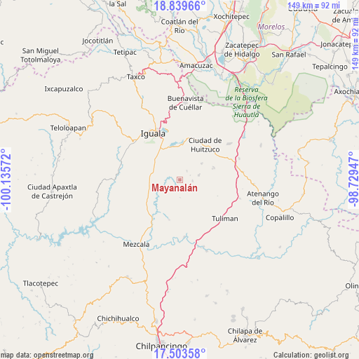
Mayanalán GPS coordinates[2]
18° 10' 22.44" North, 99° 25' 57.324" West
| Map corner | latitude | longitude |
|---|---|---|
| Upper-left | 18.83966°, | -100.13572° |
| Center: | 18.1729°, | -99.43259° |
| Lower-right: | 17.50358°, | -98.72947° |
| Map W x H: | 148.6×148.6 km | = 92.3×92.3mi |
| max Lat: | 32.7° ⇑76.5% North |
| Mayanalán: | 18.1729° |
| min Lat: | ⇓23.5% South 14.53588° |
| min Long | Mayanalán | max Long |
| -117.105° | -99.43259° | -86.73105° |
| W 44%⇐ | ⇒56% E |
Elevation
Elevation of Mayanalán is 859 m = 2818 ft, and this is 394.7 m = 1295 ft below average elevation for this country.
| Max E: |
3497 m = 11473 ft | 62.4% |
| Avg. | 1253.7 m = 4113 ft | |
| Mayanalán | 859 m = 2818 ft | |
Min E: |
-1 m = -3 ft | 37.6% |
See also: Mexico elevation on elevation.city.
Geographical zone
Mayanalán is located in North Torrid zone (between Equator and Tropic of Cancer). Distance of this Northern Tropic circle is 585.3 km =363.7 mi to North.| Distance of | km | miles | from Mayanalán |
|---|---|---|---|
| North Pole | 7986.4 | 4962.5 | to North |
| Arctic Circle | 5380.5 | 3343.3 | to North |
| Tropic Cancer | 585.3 | 363.7 | to North |
| Equator | 2020.6 | 1255.5 | to South |


Nearby cities:
15 places around Mayanalán: (largest is in red/bold)
• Acayahualco
7.7 km =4.8 mi,  318°
318°
• Cacahuananche
8.2 km =5.1 mi,  75°
75°
• Cuexcontlán
14.7 km =9.1 mi,  1°
1°
• Palula
14.2 km =8.8 mi,  232°
232°
• Pololcingo
12.7 km =7.9 mi,  19°
19°
• Rincón de la Cocina
8.7 km =5.4 mi,  335°
335°
• Sabana Grande
12.4 km =7.7 mi,  262°
262°
• Santa Cruz
4.7 km =2.9 mi,  37°
37°
• Santa Teresa
10.1 km =6.3 mi,  308°
308°
• Tepecoacuilco de Trujano
13.2 km =8.2 mi,  345°
345°
• Tierra Colorada
11.8 km =7.3 mi, 336°
• Tlapala
11.4 km =7.1 mi,  52°
52°
• Venta de Palula
14.3 km =8.9 mi,  241°
241°
• Xilocintla
5.2 km =3.2 mi,  93°
93°
• Zacacoyuca
13.2 km =8.2 mi, 310°
Sources, notices
• [Note1] Compared only with cities in Mexico existing in our database
• [Src1] Map data: © OpenStreetMap contributors (CC-BY-SA)
• [Src2] Other city data from geonames.org with taken over terms of usage.
• [Src3] Geographical zone / Annual Mean Temperature by Robert A. Rohde @ Wikipedia
