Cacahuananche geodata
Cacahuananche (Guerrero) is a populated place; located in Mexico in America/Mexico_City (GMT-6) time zone. With population of 931 people, there are 9365 cities with bigger population in this country. Compared to other cities in Mexico, 76.3% of cities are located further ↑North; 55% of cities are located further →East and 56.8% of cities have higher elevation than Cacahuananche. Note1


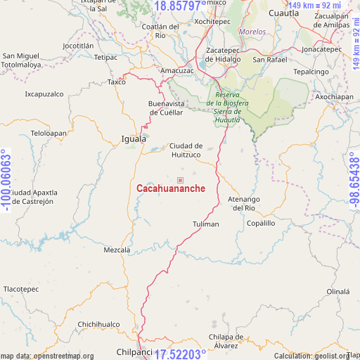
Cacahuananche GPS coordinates[2]
18° 11' 28.608" North, 99° 21' 27" West
| Map corner | latitude | longitude |
|---|---|---|
| Upper-left | 18.85797°, | -100.06063° |
| Center: | 18.19128°, | -99.3575° |
| Lower-right: | 17.52203°, | -98.65438° |
| Map W x H: | 148.5×148.5 km | = 92.3×92.3mi |
| max Lat: | 32.7° ⇑76.3% North |
| Cacahuananche: | 18.19128° |
| min Lat: | ⇓23.7% South 14.53588° |
| min Long | Cacahuananche | max Long |
| -117.105° | -99.3575° | -86.73105° |
| W 45%⇐ | ⇒55% E |
Elevation
Elevation of Cacahuananche is 1126 m = 3694 ft, and this is 127.7 m = 419 ft below average elevation for this country.
| Max E: |
3497 m = 11473 ft | 56.8% |
| Avg. | 1253.7 m = 4113 ft | |
| Cacahuananche | 1126 m = 3694 ft | |
Min E: |
-1 m = -3 ft | 43.2% |
See also: Mexico elevation on elevation.city.
Geographical zone
Cacahuananche is located in North Torrid zone (between Equator and Tropic of Cancer). Distance of this Northern Tropic circle is 583.2 km =362.4 mi to North.| Distance of | km | miles | from Cacahuananche |
|---|---|---|---|
| North Pole | 7984.4 | 4961.3 | to North |
| Arctic Circle | 5378.5 | 3342 | to North |
| Tropic Cancer | 583.2 | 362.4 | to North |
| Equator | 2022.7 | 1256.8 | to South |


Nearby cities:
15 places around Cacahuananche: (largest is in red/bold)
• Acayahualco
13.6 km =8.5 mi,  286°
286°
• Atetetla
15.3 km =9.5 mi,  353°
353°
• Ciudad de Huitzuco
12.7 km =7.9 mi,  11°
11°
• Cuexcontlán
14.7 km =9.1 mi,  329°
329°
• Lagunillas
7 km =4.3 mi,  65°
65°
• Mayanalán
8.2 km =5.1 mi,  255°
255°
• Paso Morelos
15.9 km =9.9 mi,  77°
77°
• Pololcingo
10.6 km =6.6 mi,  339°
339°
• Rincón de la Cocina
12.9 km =8 mi,  296°
296°
• San Vicente Palapa
15.8 km =9.8 mi, 339°
• Santa Cruz
5.4 km =3.4 mi, 289°
• Tepecoacuilco de Trujano
15.5 km =9.6 mi,  313°
313°
• Tierra Colorada
15.4 km =9.6 mi, 304°
• Tlapala
4.9 km =3 mi, 13°
• Xilocintla
3.6 km =2.2 mi,  228°
228°
Sources, notices
• [Note1] Compared only with cities in Mexico existing in our database
• [Src1] Map data: © OpenStreetMap contributors (CC-BY-SA)
• [Src2] Other city data from geonames.org with taken over terms of usage.
• [Src3] Geographical zone / Annual Mean Temperature by Robert A. Rohde @ Wikipedia
