Venta de Palula geodata
Venta de Palula (Guerrero) is a populated place; located in Mexico in America/Mexico_City (GMT-6) time zone. With population of 536 people, there are 15820 cities with bigger population in this country. Compared to other cities in Mexico, 77.4% of cities are located further ↑North; 57.6% of cities are located further →East and 65% of cities have higher elevation than Venta de Palula. Note1


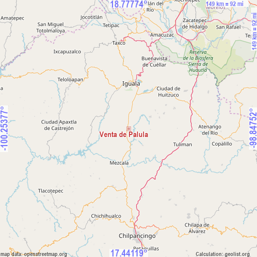
Venta de Palula GPS coordinates[2]
18° 6' 38.664" North, 99° 33' 2.304" West
| Map corner | latitude | longitude |
|---|---|---|
| Upper-left | 18.77774°, | -100.25377° |
| Center: | 18.11074°, | -99.55064° |
| Lower-right: | 17.44119°, | -98.84752° |
| Map W x H: | 148.6×148.6 km | = 92.3×92.3mi |
| max Lat: | 32.7° ⇑77.4% North |
| Venta de Palula: | 18.11074° |
| min Lat: | ⇓22.6% South 14.53588° |
| min Long | Venta de Palula | max Long |
| -117.105° | -99.55064° | -86.73105° |
| W 42.4%⇐ | ⇒57.6% E |
Elevation
Elevation of Venta de Palula is 688 m = 2257 ft, and this is 565.7 m = 1856 ft below average elevation for this country.
| Max E: |
3497 m = 11473 ft | 65% |
| Avg. | 1253.7 m = 4113 ft | |
| Venta de Palula | 688 m = 2257 ft | |
Min E: |
-1 m = -3 ft | 35% |
See also: Mexico elevation on elevation.city.
Geographical zone
Venta de Palula is located in North Torrid zone (between Equator and Tropic of Cancer). Distance of this Northern Tropic circle is 592.2 km =368 mi to North.| Distance of | km | miles | from Venta de Palula |
|---|---|---|---|
| North Pole | 7993.3 | 4966.8 | to North |
| Arctic Circle | 5387.4 | 3347.6 | to North |
| Tropic Cancer | 592.2 | 368 | to North |
| Equator | 2013.7 | 1251.3 | to South |


Nearby cities:
15 places around Venta de Palula: (largest is in red/bold)
• Acayahualco
14.7 km =9.1 mi,  30°
30°
• Ahuehuepan
12.8 km =8 mi,  155°
155°
• Ahuelicán
12.5 km =7.8 mi,  140°
140°
• Apipilulco
15.6 km =9.7 mi,  304°
304°
• Coacoyula de Álvarez
9.3 km =5.8 mi,  245°
245°
• Maxela
7.9 km =4.9 mi,  216°
216°
• Mayanalán
14.3 km =8.9 mi,  61°
61°
• Palula
2 km =1.2 mi, 144°
• Sabana Grande
5.2 km =3.2 mi,  2°
2°
• Santa Teresa
14 km =8.7 mi,  19°
19°
• Sasamulco
5.9 km =3.7 mi,  333°
333°
• Tecuexcontitlán (Tecoescontitlán)
4.6 km =2.9 mi,  320°
320°
• Tonalapa del Sur
1.7 km =1.1 mi,  212°
212°
• Xalitla
12.6 km =7.8 mi,  176°
176°
• Zacacoyuca
15.7 km =9.8 mi,  8°
8°
Sources, notices
• [Note1] Compared only with cities in Mexico existing in our database
• [Src1] Map data: © OpenStreetMap contributors (CC-BY-SA)
• [Src2] Other city data from geonames.org with taken over terms of usage.
• [Src3] Geographical zone / Annual Mean Temperature by Robert A. Rohde @ Wikipedia
