Maravilla Tenejapa geodata
Maravilla Tenejapa (Chiapas) is a seat of a second-order administrative division; located in Mexico in America/Mexico_City (GMT-6) time zone. With population of 1,477 people, there are 5846 cities with bigger population in this country. Compared to other cities in Mexico, 96.7% of cities are located further ↑North; 96.6% of cities are located further ←West and 70.9% of cities have higher elevation than Maravilla Tenejapa. Note1


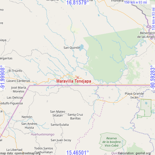
Maravilla Tenejapa GPS coordinates[2]
16° 8' 29.58" North, 91° 17' 45.42" West
| Map corner | latitude | longitude |
|---|---|---|
| Upper-left | 16.81579°, | -91.99908° |
| Center: | 16.14155°, | -91.29595° |
| Lower-right: | 15.46501°, | -90.59283° |
| Map W x H: | 150.2×150.2 km | = 93.3×93.3mi |
| max Lat: | 32.7° ⇑96.7% North |
| Maravilla Tenejapa: | 16.14155° |
| min Lat: | ⇓3.3% South 14.53588° |
| min Long | Maravilla Tenej | max Long |
| -117.105° | -91.29595° | -86.73105° |
| W 96.6%⇐ | ⇒3.4% E |
Elevation
Elevation of Maravilla Tenejapa is 374 m = 1227 ft, and this is 879.7 m = 2886 ft below average elevation for this country.
| Max E: |
3497 m = 11473 ft | 70.9% |
| Avg. | 1253.7 m = 4113 ft | |
| Maravilla Tenejapa | 374 m = 1227 ft | |
Min E: |
-1 m = -3 ft | 29.1% |
See also: Mexico elevation on elevation.city.
Geographical zone
Maravilla Tenejapa is located in North Torrid zone (between Equator and Tropic of Cancer). Distance of this Northern Tropic circle is 811.1 km =504 mi to North.| Distance of | km | miles | from Maravilla Tenejapa |
|---|---|---|---|
| North Pole | 8212.3 | 5102.9 | to North |
| Arctic Circle | 5606.4 | 3483.7 | to North |
| Tropic Cancer | 811.1 | 504 | to North |
| Equator | 1794.8 | 1115.2 | to South |


Nearby cities:
15 places around Maravilla Tenejapa: (largest is in red/bold)
• Amparo Agua Tinta
20.8 km =12.9 mi,  268°
268°
• El Ixcán
22.5 km =14 mi,  105°
105°
• Guadalupe Miramar
2.5 km =1.6 mi,  42°
42°
• Jerusalén
9.9 km =6.2 mi,  295°
295°
• Nueva Providencia
27.3 km =17 mi,  344°
344°
• Nueva Sabanilla
15.8 km =9.8 mi,  29°
29°
• Nuevo Huixtán
12.7 km =7.9 mi,  277°
277°
• Nuevo Matzám
7.4 km =4.6 mi,  254°
254°
• Nuevo Poza Rica
12.3 km =7.6 mi, 281°
• Nuevo Rodulfo Figueroa
9.6 km =6 mi,  22°
22°
• Nuevo San Juan Chamula
15.8 km =9.8 mi, 271°
• Nuevo Santo Tomás
14 km =8.7 mi, 299°
• San Antonio los Montes
23.4 km =14.5 mi,  288°
288°
• San Pedro Yutniotic
11.5 km =7.1 mi,  237°
237°
• Santo Domingo de las Palmas
2.8 km =1.7 mi,  258°
258°
Sources, notices
• [Note1] Compared only with cities in Mexico existing in our database
• [Src1] Map data: © OpenStreetMap contributors (CC-BY-SA)
• [Src2] Other city data from geonames.org with taken over terms of usage.
• [Src3] Geographical zone / Annual Mean Temperature by Robert A. Rohde @ Wikipedia
