Maney geodata
Maney (Hidalgo) is a populated place; located in Mexico in America/Mexico_City (GMT-6) time zone. With population of 972 people, there are 8937 cities with bigger population in this country. Compared to other cities in Mexico, 65.5% of cities are located further ↓South; 60% of cities are located further →East and 77.4% of cities have lower elevation than Maney. Note1


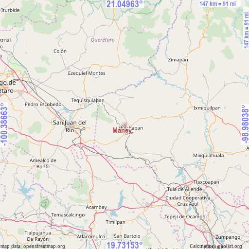
Maney GPS coordinates[2]
20° 23' 31.164" North, 99° 41' 0.6" West
| Map corner | latitude | longitude |
|---|---|---|
| Upper-left | 21.04963°, | -100.38663° |
| Center: | 20.39199°, | -99.6835° |
| Lower-right: | 19.73153°, | -98.98038° |
| Map W x H: | 146.6×146.6 km | = 91.1×91.1mi |
| max Lat: | 32.7° ⇑34.5% North |
| Maney: | 20.39199° |
| min Lat: | ⇓65.5% South 14.53588° |
| min Long | Maney | max Long |
| -117.105° | -99.6835° | -86.73105° |
| W 40%⇐ | ⇒60% E |
Elevation
Elevation of Maney is 2077 m = 6814 ft, and this is 823.3 m = 2701 ft above average elevation for this country.
| Max E: |
3497 m = 11473 ft | 22.6% |
| Maney | 2077 m 6814 ft | |
| Avg. | 1253.7 m = 4113 ft | |
Min E: |
-1 m = -3 ft | 77.4% |
See also: Mexico elevation on elevation.city.
Geographical zone
Maney is located in North Torrid zone (between Equator and Tropic of Cancer). Distance of this Northern Tropic circle is 338.5 km =210.3 mi to North.| Distance of | km | miles | from Maney |
|---|---|---|---|
| North Pole | 7739.7 | 4809.2 | to North |
| Arctic Circle | 5133.8 | 3190 | to North |
| Tropic Cancer | 338.5 | 210.3 | to North |
| Equator | 2267.4 | 1408.9 | to South |


Nearby cities:
15 places around Maney: (largest is in red/bold)
• Bondojito
6 km =3.7 mi,  343°
343°
• Dongoteay
3.7 km =2.3 mi,  174°
174°
• El Cajón
6 km =3.7 mi,  95°
95°
• El Saucillo
8.9 km =5.5 mi,  194°
194°
• Huichapan
4 km =2.5 mi,  116°
116°
• La Cruz
8.1 km =5 mi,  268°
268°
• La Sabinita
6.1 km =3.8 mi, 122°
• Mamithi
3.3 km =2.1 mi,  52°
52°
• Maxtha
10.4 km =6.5 mi, 52°
• Pedregoso
8 km =5 mi,  147°
147°
• Sabina Grande
6.4 km =4 mi,  106°
106°
• San Francisco
10.5 km =6.5 mi,  330°
330°
• San José Atlán
6 km =3.7 mi, 170°
• Taguí
7.5 km =4.7 mi,  37°
37°
• Zothé
4.2 km =2.6 mi,  233°
233°
Sources, notices
• [Note1] Compared only with cities in Mexico existing in our database
• [Src1] Map data: © OpenStreetMap contributors (CC-BY-SA)
• [Src2] Other city data from geonames.org with taken over terms of usage.
• [Src3] Geographical zone / Annual Mean Temperature by Robert A. Rohde @ Wikipedia
