Magdalena geodata
Magdalena (Veracruz) is a populated place; located in Mexico in America/Mexico_City (GMT-6) time zone. With population of 689 people, there are 12616 cities with bigger population in this country. Compared to other cities in Mexico, 69.3% of cities are located further ↑North; 74.2% of cities are located further ←West and 51.6% of cities have lower elevation than Magdalena. Note1


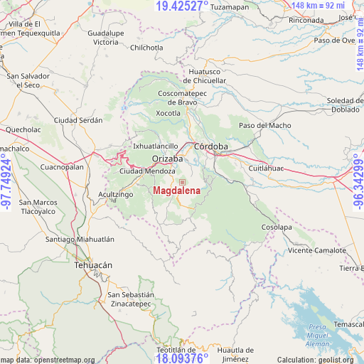
Magdalena GPS coordinates[2]
18° 45' 38.988" North, 97° 2' 45.996" West
| Map corner | latitude | longitude |
|---|---|---|
| Upper-left | 19.42527°, | -97.74924° |
| Center: | 18.76083°, | -97.04611° |
| Lower-right: | 18.09376°, | -96.34299° |
| Map W x H: | 148.1×148.1 km | = 92×92mi |
| max Lat: | 32.7° ⇑69.3% North |
| Magdalena: | 18.76083° |
| min Lat: | ⇓30.7% South 14.53588° |
| min Long | Magdalena | max Long |
| -117.105° | -97.04611° | -86.73105° |
| W 74.2%⇐ | ⇒25.8% E |
Elevation
Elevation of Magdalena is 1511 m = 4957 ft, and this is 257.3 m = 844 ft above average elevation for this country.
| Max E: |
3497 m = 11473 ft | 48.4% |
| Magdalena | 1511 m 4957 ft | |
| Avg. | 1253.7 m = 4113 ft | |
Min E: |
-1 m = -3 ft | 51.6% |
See also: Mexico elevation on elevation.city.
Geographical zone
Magdalena is located in North Torrid zone (between Equator and Tropic of Cancer). Distance of this Northern Tropic circle is 519.9 km =323.1 mi to North.| Distance of | km | miles | from Magdalena |
|---|---|---|---|
| North Pole | 7921.1 | 4921.9 | to North |
| Arctic Circle | 5315.2 | 3302.7 | to North |
| Tropic Cancer | 519.9 | 323.1 | to North |
| Equator | 2086 | 1296.2 | to South |


Nearby cities:
15 places around Magdalena: (largest is in red/bold)
• Atlanca
6.9 km =4.3 mi,  187°
187°
• Capoluca
5.4 km =3.4 mi,  21°
21°
• Capultitla
0.4 km =0.2 mi,  133°
133°
• El Campanario
7.3 km =4.5 mi,  85°
85°
• Oxtotitla
5.7 km =3.5 mi,  135°
135°
• Rafael Delgado
6.1 km =3.8 mi,  333°
333°
• Rincón de Maravillas
5.7 km =3.5 mi,  63°
63°
• San Andrés Tenejapan
5.9 km =3.7 mi,  302°
302°
• Santa Cruz
4.9 km =3 mi,  222°
222°
• Teotzacualco
6.8 km =4.2 mi,  121°
121°
• Tequila
4.2 km =2.6 mi, 216°
• Tlecuaxco
5.6 km =3.5 mi, 92°
• Tolapa
4.6 km =2.9 mi,  240°
240°
• Tonalixco
2.7 km =1.7 mi, 328°
• Tuxpanguillo
4.2 km =2.6 mi, 55°
Sources, notices
• [Note1] Compared only with cities in Mexico existing in our database
• [Src1] Map data: © OpenStreetMap contributors (CC-BY-SA)
• [Src2] Other city data from geonames.org with taken over terms of usage.
• [Src3] Geographical zone / Annual Mean Temperature by Robert A. Rohde @ Wikipedia
