Capultitla geodata
Capultitla (Veracruz) is a populated place; located in Mexico in America/Mexico_City (GMT-6) time zone. With population of 546 people, there are 15582 cities with bigger population in this country. Compared to other cities in Mexico, 69.4% of cities are located further ↑North; 74.3% of cities are located further ←West and 51.3% of cities have lower elevation than Capultitla. Note1


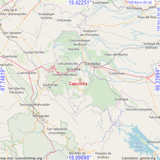
Capultitla GPS coordinates[2]
18° 45' 29.016" North, 97° 2' 35.016" West
| Map corner | latitude | longitude |
|---|---|---|
| Upper-left | 19.42251°, | -97.74619° |
| Center: | 18.75806°, | -97.04306° |
| Lower-right: | 18.09098°, | -96.33994° |
| Map W x H: | 148.1×148.1 km | = 92×92mi |
| max Lat: | 32.7° ⇑69.4% North |
| Capultitla: | 18.75806° |
| min Lat: | ⇓30.6% South 14.53588° |
| min Long | Capultitla | max Long |
| -117.105° | -97.04306° | -86.73105° |
| W 74.3%⇐ | ⇒25.7% E |
Elevation
Elevation of Capultitla is 1498 m = 4915 ft, and this is 244.3 m = 802 ft above average elevation for this country.
| Max E: |
3497 m = 11473 ft | 48.7% |
| Capultitla | 1498 m 4915 ft | |
| Avg. | 1253.7 m = 4113 ft | |
Min E: |
-1 m = -3 ft | 51.3% |
See also: Mexico elevation on elevation.city.
Geographical zone
Capultitla is located in North Torrid zone (between Equator and Tropic of Cancer). Distance of this Northern Tropic circle is 520.2 km =323.2 mi to North.| Distance of | km | miles | from Capultitla |
|---|---|---|---|
| North Pole | 7921.4 | 4922.1 | to North |
| Arctic Circle | 5315.5 | 3302.9 | to North |
| Tropic Cancer | 520.2 | 323.2 | to North |
| Equator | 2085.7 | 1296 | to South |


Nearby cities:
15 places around Capultitla: (largest is in red/bold)
• Atlanca
6.7 km =4.2 mi,  190°
190°
• Capoluca
5.6 km =3.5 mi,  17°
17°
• El Campanario
7 km =4.3 mi,  82°
82°
• Magdalena
0.4 km =0.2 mi,  313°
313°
• Oxtotitla
5.3 km =3.3 mi,  135°
135°
• Rafael Delgado
6.5 km =4 mi,  332°
332°
• Rincón de Maravillas
5.6 km =3.5 mi,  58°
58°
• San Andrés Tenejapan
6.4 km =4 mi,  302°
302°
• Santa Cruz
4.9 km =3 mi,  228°
228°
• Teotzacualco
6.4 km =4 mi,  120°
120°
• Tequila
4.2 km =2.6 mi,  222°
222°
• Tlecuaxco
5.3 km =3.3 mi,  89°
89°
• Tolapa
4.7 km =2.9 mi,  245°
245°
• Tonalixco
3.2 km =2 mi, 326°
• Tuxpanguillo
4.2 km =2.6 mi,  49°
49°
Sources, notices
• [Note1] Compared only with cities in Mexico existing in our database
• [Src1] Map data: © OpenStreetMap contributors (CC-BY-SA)
• [Src2] Other city data from geonames.org with taken over terms of usage.
• [Src3] Geographical zone / Annual Mean Temperature by Robert A. Rohde @ Wikipedia
