Atlanca geodata
Atlanca (Veracruz) is a populated place; located in Mexico in America/Mexico_City (GMT-6) time zone. With population of 733 people, there are 11918 cities with bigger population in this country. Compared to other cities in Mexico, 70.2% of cities are located further ↑North; 74.1% of cities are located further ←West and 60.2% of cities have lower elevation than Atlanca. Note1


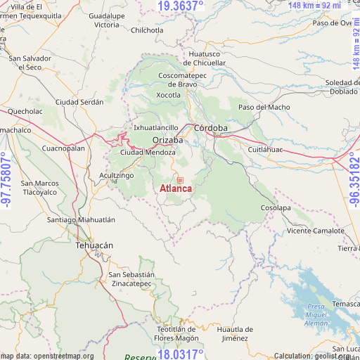
Atlanca GPS coordinates[2]
18° 41' 56.436" North, 97° 3' 17.784" West
| Map corner | latitude | longitude |
|---|---|---|
| Upper-left | 19.3637°, | -97.75807° |
| Center: | 18.69901°, | -97.05494° |
| Lower-right: | 18.0317°, | -96.35182° |
| Map W x H: | 148.1×148.1 km | = 92×92mi |
| max Lat: | 32.7° ⇑70.2% North |
| Atlanca: | 18.69901° |
| min Lat: | ⇓29.8% South 14.53588° |
| min Long | Atlanca | max Long |
| -117.105° | -97.05494° | -86.73105° |
| W 74.1%⇐ | ⇒25.9% E |
Elevation
Elevation of Atlanca is 1729 m = 5673 ft, and this is 475.3 m = 1559 ft above average elevation for this country.
| Max E: |
3497 m = 11473 ft | 39.8% |
| Atlanca | 1729 m 5673 ft | |
| Avg. | 1253.7 m = 4113 ft | |
Min E: |
-1 m = -3 ft | 60.2% |
See also: Mexico elevation on elevation.city.
Geographical zone
Atlanca is located in North Torrid zone (between Equator and Tropic of Cancer). Distance of this Northern Tropic circle is 526.8 km =327.3 mi to North.| Distance of | km | miles | from Atlanca |
|---|---|---|---|
| North Pole | 7927.9 | 4926.2 | to North |
| Arctic Circle | 5322 | 3306.9 | to North |
| Tropic Cancer | 526.8 | 327.3 | to North |
| Equator | 2079.1 | 1291.9 | to South |


Nearby cities:
15 places around Atlanca: (largest is in red/bold)
• Atlahuilco
3.9 km =2.4 mi,  266°
266°
• Capultitla
6.7 km =4.2 mi,  10°
10°
• Los Reyes
3.4 km =2.1 mi,  158°
158°
• Magdalena
6.9 km =4.3 mi, 7°
• Oxtotitla
5.7 km =3.5 mi,  60°
60°
• Santa Cruz
4.1 km =2.5 mi,  323°
323°
• Teotzacualco
7.5 km =4.7 mi, 64°
• Tepetitlanapa
7.6 km =4.7 mi,  144°
144°
• Tequila
3.8 km =2.4 mi,  335°
335°
• Texhuacán
8.7 km =5.4 mi,  169°
169°
• Tlalca
8.6 km =5.3 mi, 172°
• Tolapa
5.5 km =3.4 mi,  326°
326°
• Xibtla
3.3 km =2.1 mi,  215°
215°
• Zacamilola
4.5 km =2.8 mi, 222°
• Zongolica
7.1 km =4.4 mi,  120°
120°
Sources, notices
• [Note1] Compared only with cities in Mexico existing in our database
• [Src1] Map data: © OpenStreetMap contributors (CC-BY-SA)
• [Src2] Other city data from geonames.org with taken over terms of usage.
• [Src3] Geographical zone / Annual Mean Temperature by Robert A. Rohde @ Wikipedia
