Santa Cruz geodata
Santa Cruz (Veracruz) is a populated place; located in Mexico in America/Mexico_City (GMT-6) time zone. With population of 605 people, there are 14228 cities with bigger population in this country. Compared to other cities in Mexico, 69.9% of cities are located further ↑North; 73.9% of cities are located further ←West and 64.5% of cities have lower elevation than Santa Cruz. Note1


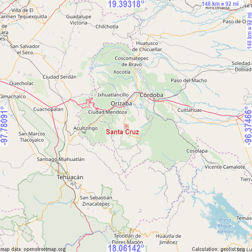
Santa Cruz GPS coordinates[2]
18° 43' 42.996" North, 97° 4' 40.008" West
| Map corner | latitude | longitude |
|---|---|---|
| Upper-left | 19.39318°, | -97.78091° |
| Center: | 18.72861°, | -97.07778° |
| Lower-right: | 18.06142°, | -96.37466° |
| Map W x H: | 148.1×148.1 km | = 92×92mi |
| max Lat: | 32.7° ⇑69.9% North |
| Santa Cruz: | 18.72861° |
| min Lat: | ⇓30.1% South 14.53588° |
| min Long | Santa Cruz | max Long |
| -117.105° | -97.07778° | -86.73105° |
| W 73.9%⇐ | ⇒26.1% E |
Elevation
Elevation of Santa Cruz is 1813 m = 5948 ft, and this is 559.3 m = 1835 ft above average elevation for this country.
| Max E: |
3497 m = 11473 ft | 35.5% |
| Santa Cruz | 1813 m 5948 ft | |
| Avg. | 1253.7 m = 4113 ft | |
Min E: |
-1 m = -3 ft | 64.5% |
See also: Mexico elevation on elevation.city.
Geographical zone
Santa Cruz is located in North Torrid zone (between Equator and Tropic of Cancer). Distance of this Northern Tropic circle is 523.5 km =325.3 mi to North.| Distance of | km | miles | from Santa Cruz |
|---|---|---|---|
| North Pole | 7924.6 | 4924.1 | to North |
| Arctic Circle | 5318.7 | 3304.9 | to North |
| Tropic Cancer | 523.5 | 325.3 | to North |
| Equator | 2082.4 | 1293.9 | to South |


Nearby cities:
15 places around Santa Cruz: (largest is in red/bold)
• Atlahuilco
3.8 km =2.4 mi,  202°
202°
• Atlanca
4.1 km =2.5 mi,  143°
143°
• Capultitla
4.9 km =3 mi,  48°
48°
• Magdalena
4.9 km =3 mi,  42°
42°
• Monterrey
7.3 km =4.5 mi,  280°
280°
• Oxtotitla
7.4 km =4.6 mi,  93°
93°
• San Andrés Tenejapan
7 km =4.3 mi,  345°
345°
• Tequila
0.8 km =0.5 mi,  79°
79°
• Tlatilpa
7 km =4.3 mi,  274°
274°
• Tlatzala
6.7 km =4.2 mi, 270°
• Tolapa
1.4 km =0.9 mi,  333°
333°
• Tonalixco
6.2 km =3.9 mi,  17°
17°
• Tzoncolco
7.2 km =4.5 mi,  314°
314°
• Xibtla
6 km =3.7 mi,  175°
175°
• Zacamilola
6.7 km =4.2 mi,  185°
185°
Sources, notices
• [Note1] Compared only with cities in Mexico existing in our database
• [Src1] Map data: © OpenStreetMap contributors (CC-BY-SA)
• [Src2] Other city data from geonames.org with taken over terms of usage.
• [Src3] Geographical zone / Annual Mean Temperature by Robert A. Rohde @ Wikipedia
