Loma de Sogotegoyo geodata
Loma de Sogotegoyo (Veracruz) is a populated place; located in Mexico in America/Mexico_City (GMT-6) time zone. With population of 1,245 people, there are 6968 cities with bigger population in this country. Compared to other cities in Mexico, 76% of cities are located further ↑North; 84.7% of cities are located further ←West and 68% of cities have higher elevation than Loma de Sogotegoyo. Note1


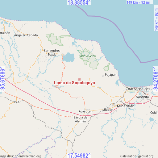
Loma de Sogotegoyo GPS coordinates[2]
18° 13' 8.256" North, 94° 58' 25.428" West
| Map corner | latitude | longitude |
|---|---|---|
| Upper-left | 18.88554°, | -95.67686° |
| Center: | 18.21896°, | -94.97373° |
| Lower-right: | 17.54982°, | -94.27061° |
| Map W x H: | 148.5×148.5 km | = 92.3×92.3mi |
| max Lat: | 32.7° ⇑76% North |
| Loma de Sogotegoyo: | 18.21896° |
| min Lat: | ⇓24% South 14.53588° |
| min Long | Loma de Sogoteg | max Long |
| -117.105° | -94.97373° | -86.73105° |
| W 84.7%⇐ | ⇒15.3% E |
Elevation
Elevation of Loma de Sogotegoyo is 529 m = 1736 ft, and this is 724.7 m = 2378 ft below average elevation for this country.
| Max E: |
3497 m = 11473 ft | 68% |
| Avg. | 1253.7 m = 4113 ft | |
| Loma de Sogotegoyo | 529 m = 1736 ft | |
Min E: |
-1 m = -3 ft | 32% |
See also: Mexico elevation on elevation.city.
Geographical zone
Loma de Sogotegoyo is located in North Torrid zone (between Equator and Tropic of Cancer). Distance of this Northern Tropic circle is 580.2 km =360.5 mi to North.| Distance of | km | miles | from Loma de Sogotegoyo |
|---|---|---|---|
| North Pole | 7981.3 | 4959.3 | to North |
| Arctic Circle | 5375.4 | 3340.1 | to North |
| Tropic Cancer | 580.2 | 360.5 | to North |
| Equator | 2025.8 | 1258.8 | to South |


Nearby cities:
15 places around Loma de Sogotegoyo: (largest is in red/bold)
• Buenavista
4.4 km =2.7 mi,  76°
76°
• Cuilonia Nuevo
9.5 km =5.9 mi,  138°
138°
• El Aguacate
2.3 km =1.4 mi,  171°
171°
• El Tulín
3.8 km =2.4 mi,  33°
33°
• General Hilario C. Salas
6.3 km =3.9 mi,  342°
342°
• Las Palomas (Bajo Paloma)
11.1 km =6.9 mi, 136°
• Loma de la Palma
3.2 km =2 mi,  332°
332°
• Morelos
5 km =3.1 mi,  149°
149°
• Nacaxtle
11.3 km =7 mi,  231°
231°
• Ocozotepec
8 km =5 mi,  56°
56°
• Sabaneta
11.3 km =7 mi,  272°
272°
• San Fernando
10.9 km =6.8 mi, 59°
• Santa Rosa Loma Larga
12 km =7.5 mi,  276°
276°
• Soteapan
10.8 km =6.7 mi, 81°
• Tierra Nueva
5.2 km =3.2 mi,  256°
256°
Sources, notices
• [Note1] Compared only with cities in Mexico existing in our database
• [Src1] Map data: © OpenStreetMap contributors (CC-BY-SA)
• [Src2] Other city data from geonames.org with taken over terms of usage.
• [Src3] Geographical zone / Annual Mean Temperature by Robert A. Rohde @ Wikipedia
