Soteapan geodata
Soteapan (Veracruz) is a seat of a second-order administrative division; located in Mexico in America/Mexico_City (GMT-6) time zone. With population of 5,118 people, there are 1812 cities with bigger population in this country. Compared to other cities in Mexico, 75.8% of cities are located further ↑North; 84.9% of cities are located further ←West and 69.4% of cities have higher elevation than Soteapan. Note1


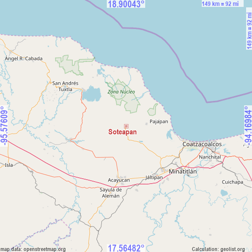
Soteapan GPS coordinates[2]
18° 14' 2.076" North, 94° 52' 22.656" West
| Map corner | latitude | longitude |
|---|---|---|
| Upper-left | 18.90043°, | -95.57609° |
| Center: | 18.23391°, | -94.87296° |
| Lower-right: | 17.56482°, | -94.16984° |
| Map W x H: | 148.5×148.5 km | = 92.3×92.3mi |
| max Lat: | 32.7° ⇑75.8% North |
| Soteapan: | 18.23391° |
| min Lat: | ⇓24.2% South 14.53588° |
| min Long | Soteapan | max Long |
| -117.105° | -94.87296° | -86.73105° |
| W 84.9%⇐ | ⇒15.1% E |
Elevation
Elevation of Soteapan is 450 m = 1476 ft, and this is 803.7 m = 2637 ft below average elevation for this country.
| Max E: |
3497 m = 11473 ft | 69.4% |
| Avg. | 1253.7 m = 4113 ft | |
| Soteapan | 450 m = 1476 ft | |
Min E: |
-1 m = -3 ft | 30.6% |
See also: Mexico elevation on elevation.city.
Geographical zone
Soteapan is located in North Torrid zone (between Equator and Tropic of Cancer). Distance of this Northern Tropic circle is 578.5 km =359.5 mi to North.| Distance of | km | miles | from Soteapan |
|---|---|---|---|
| North Pole | 7979.6 | 4958.3 | to North |
| Arctic Circle | 5373.8 | 3339.1 | to North |
| Tropic Cancer | 578.5 | 359.5 | to North |
| Equator | 2027.4 | 1259.8 | to South |


Nearby cities:
15 places around Soteapan: (largest is in red/bold)
• Buenavista
6.4 km =4 mi,  264°
264°
• Cerro de la Palma
8.7 km =5.4 mi,  153°
153°
• Cuilonia Nuevo
9.8 km =6.1 mi,  206°
206°
• El Aguacate
11 km =6.8 mi,  248°
248°
• El Tulín
8.7 km =5.4 mi,  280°
280°
• Encino Amarillo
10.5 km =6.5 mi,  54°
54°
• Ixhuapán
10.1 km =6.3 mi,  129°
129°
• Las Palomas (Bajo Paloma)
10.1 km =6.3 mi,  196°
196°
• Loma de Sogotegoyo
10.8 km =6.7 mi, 261°
• Mecayapan
4 km =2.5 mi,  112°
112°
• Morelos
10.1 km =6.3 mi,  233°
233°
• Ocotal Chico
3 km =1.9 mi,  26°
26°
• Ocozotepec
4.8 km =3 mi,  305°
305°
• Saltillo
8.6 km =5.3 mi,  165°
165°
• San Fernando
4.1 km =2.5 mi,  342°
342°
Sources, notices
• [Note1] Compared only with cities in Mexico existing in our database
• [Src1] Map data: © OpenStreetMap contributors (CC-BY-SA)
• [Src2] Other city data from geonames.org with taken over terms of usage.
• [Src3] Geographical zone / Annual Mean Temperature by Robert A. Rohde @ Wikipedia
