Libres geodata
Libres (Puebla) is a seat of a second-order administrative division; located in Mexico in America/Mexico_City (GMT-6) time zone. With population of 15,536 people, there are 614 cities with bigger population in this country. Compared to other cities in Mexico, 54.8% of cities are located further ↑North; 67.4% of cities are located further ←West and 89.6% of cities have lower elevation than Libres. Note1


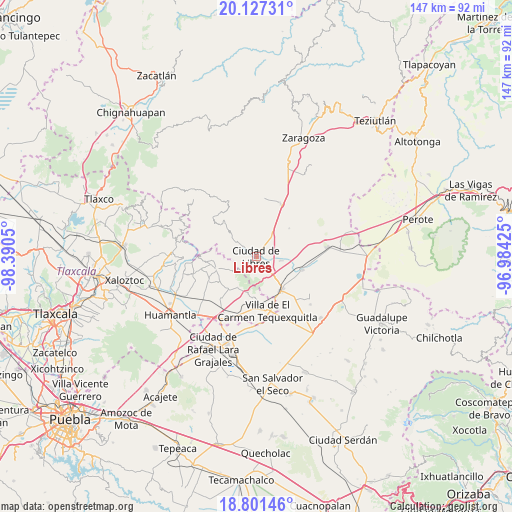
Libres GPS coordinates[2]
19° 27' 56.664" North, 97° 41' 14.532" West
| Map corner | latitude | longitude |
|---|---|---|
| Upper-left | 20.12731°, | -98.3905° |
| Center: | 19.46574°, | -97.68737° |
| Lower-right: | 18.80146°, | -96.98425° |
| Map W x H: | 147.4×147.4 km | = 91.6×91.6mi |
| max Lat: | 32.7° ⇑54.8% North |
| Libres: | 19.46574° |
| min Lat: | ⇓45.2% South 14.53588° |
| min Long | Libres | max Long |
| -117.105° | -97.68737° | -86.73105° |
| W 67.4%⇐ | ⇒32.6% E |
Elevation
Elevation of Libres is 2394 m = 7854 ft, and this is 1140.3 m = 3741 ft above average elevation for this country.
| Max E: |
3497 m = 11473 ft | 10.4% |
| Libres | 2394 m 7854 ft | |
| Avg. | 1253.7 m = 4113 ft | |
Min E: |
-1 m = -3 ft | 89.6% |
See also: Mexico elevation on elevation.city.
Geographical zone
Libres is located in North Torrid zone (between Equator and Tropic of Cancer). Distance of this Northern Tropic circle is 441.5 km =274.3 mi to North.| Distance of | km | miles | from Libres |
|---|---|---|---|
| North Pole | 7842.7 | 4873.2 | to North |
| Arctic Circle | 5236.8 | 3254 | to North |
| Tropic Cancer | 441.5 | 274.3 | to North |
| Equator | 2164.4 | 1344.9 | to South |


Nearby cities:
15 places around Libres: (largest is in red/bold)
• Ayehualaco (San Martín)
3.7 km =2.3 mi,  213°
213°
• Cuauhtzolco
2.4 km =1.5 mi,  19°
19°
• El Mirador (San Francisco)
8.3 km =5.2 mi, 18°
• Guerrero
3.7 km =2.3 mi,  180°
180°
• La Cañada
6.1 km =3.8 mi,  307°
307°
• Nuevo México
7.4 km =4.6 mi,  99°
99°
• Progreso
2.7 km =1.7 mi, 22°
• San Andrés Payuca
9.9 km =6.2 mi,  47°
47°
• San Antonio Virreyes
8.2 km =5.1 mi,  139°
139°
• San Carlos
3 km =1.9 mi,  185°
185°
• San José la Libertad
2.6 km =1.6 mi,  324°
324°
• Santa María las Cuevas
10.4 km =6.5 mi, 211°
• Tehuatzingo
6.2 km =3.9 mi,  9°
9°
• Xaltitla
10.3 km =6.4 mi,  242°
242°
• Álvaro Obregón (San Francisco)
2.6 km =1.6 mi,  159°
159°
Sources, notices
• [Note1] Compared only with cities in Mexico existing in our database
• [Src1] Map data: © OpenStreetMap contributors (CC-BY-SA)
• [Src2] Other city data from geonames.org with taken over terms of usage.
• [Src3] Geographical zone / Annual Mean Temperature by Robert A. Rohde @ Wikipedia
