Nuevo México geodata
Nuevo México (Puebla) is a populated place; located in Mexico in America/Mexico_City (GMT-6) time zone. With population of 1,756 people, there are 4942 cities with bigger population in this country. Compared to other cities in Mexico, 55% of cities are located further ↑North; 68.3% of cities are located further ←West and 88.2% of cities have lower elevation than Nuevo México. Note1


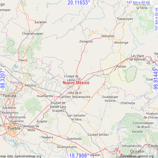
Nuevo México GPS coordinates[2]
19° 27' 17.712" North, 97° 37' 3.252" West
| Map corner | latitude | longitude |
|---|---|---|
| Upper-left | 20.11653°, | -98.3207° |
| Center: | 19.45492°, | -97.61757° |
| Lower-right: | 18.7906°, | -96.91445° |
| Map W x H: | 147.4×147.4 km | = 91.6×91.6mi |
| max Lat: | 32.7° ⇑55% North |
| Nuevo México: | 19.45492° |
| min Lat: | ⇓45% South 14.53588° |
| min Long | Nuevo México | max Long |
| -117.105° | -97.61757° | -86.73105° |
| W 68.3%⇐ | ⇒31.7% E |
Elevation
Elevation of Nuevo México is 2349 m = 7707 ft, and this is 1095.3 m = 3594 ft above average elevation for this country.
| Max E: |
3497 m = 11473 ft | 11.8% |
| Nuevo México | 2349 m 7707 ft | |
| Avg. | 1253.7 m = 4113 ft | |
Min E: |
-1 m = -3 ft | 88.2% |
See also: Mexico elevation on elevation.city.
Geographical zone
Nuevo México is located in North Torrid zone (between Equator and Tropic of Cancer). Distance of this Northern Tropic circle is 442.7 km =275.1 mi to North.| Distance of | km | miles | from Nuevo México |
|---|---|---|---|
| North Pole | 7843.9 | 4874 | to North |
| Arctic Circle | 5238 | 3254.7 | to North |
| Tropic Cancer | 442.7 | 275.1 | to North |
| Equator | 2163.2 | 1344.1 | to South |


Nearby cities:
15 places around Nuevo México: (largest is in red/bold)
• Allende
9.6 km =6 mi,  12°
12°
• Ayehualaco (San Martín)
9.5 km =5.9 mi,  258°
258°
• Cuauhtzolco
7.4 km =4.6 mi,  297°
297°
• El Fuerte de la Unión
6.5 km =4 mi,  114°
114°
• Guerrero
7.7 km =4.8 mi,  251°
251°
• Libres
7.4 km =4.6 mi,  279°
279°
• Oriental
8.8 km =5.5 mi,  182°
182°
• Progreso
7.3 km =4.5 mi, 300°
• San Andrés Payuca
7.9 km =4.9 mi,  359°
359°
• San Antonio Virreyes
5.4 km =3.4 mi,  202°
202°
• San Carlos
7.8 km =4.8 mi, 256°
• San José la Libertad
9.5 km =5.9 mi,  290°
290°
• Tehuatzingo
9.6 km =6 mi,  319°
319°
• Tetipanapa
8.7 km =5.4 mi,  81°
81°
• Álvaro Obregón (San Francisco)
6.5 km =4 mi, 259°
Sources, notices
• [Note1] Compared only with cities in Mexico existing in our database
• [Src1] Map data: © OpenStreetMap contributors (CC-BY-SA)
• [Src2] Other city data from geonames.org with taken over terms of usage.
• [Src3] Geographical zone / Annual Mean Temperature by Robert A. Rohde @ Wikipedia
