Rancho de Pro geodata
Rancho de Pro (San Luis Potosí) is a populated place; located in Mexico in America/Mexico_City (GMT-6) time zone. With population of 747 people, there are 11723 cities with bigger population in this country. Compared to other cities in Mexico, 84.7% of cities are located further ↓South; 58.1% of cities are located further →East and 52.1% of cities have higher elevation than Rancho de Pro. Note1


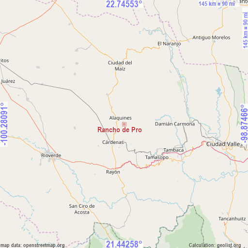
Rancho de Pro GPS coordinates[2]
22° 5' 44.016" North, 99° 34' 40.008" West
| Map corner | latitude | longitude |
|---|---|---|
| Upper-left | 22.74553°, | -100.28091° |
| Center: | 22.09556°, | -99.57778° |
| Lower-right: | 21.44258°, | -98.87466° |
| Map W x H: | 144.9×144.9 km | = 90×90mi |
| max Lat: | 32.7° ⇑15.3% North |
| Rancho de Pro: | 22.09556° |
| min Lat: | ⇓84.7% South 14.53588° |
| min Long | Rancho de Pro | max Long |
| -117.105° | -99.57778° | -86.73105° |
| W 41.9%⇐ | ⇒58.1% E |
Elevation
Elevation of Rancho de Pro is 1331 m = 4367 ft, and this is 77.3 m = 254 ft above average elevation for this country.
| Max E: |
3497 m = 11473 ft | 52.1% |
| Rancho de Pro | 1331 m 4367 ft | |
| Avg. | 1253.7 m = 4113 ft | |
Min E: |
-1 m = -3 ft | 47.9% |
See also: Mexico elevation on elevation.city.
Geographical zone
Rancho de Pro is located in North Torrid zone (between Equator and Tropic of Cancer). Distance of this Northern Tropic circle is 149.1 km =92.6 mi to North.| Distance of | km | miles | from Rancho de Pro |
|---|---|---|---|
| North Pole | 7550.3 | 4691.5 | to North |
| Arctic Circle | 4944.4 | 3072.3 | to North |
| Tropic Cancer | 149.1 | 92.6 | to North |
| Equator | 2456.8 | 1526.6 | to South |


Nearby cities:
15 places around Rancho de Pro: (largest is in red/bold)
• Agua Buena
24.3 km =15.1 mi,  128°
128°
• Alaquines
4.5 km =2.8 mi,  327°
327°
• Cañada
5.2 km =3.2 mi,  147°
147°
• Cerrito de la Cruz
26.7 km =16.6 mi,  211°
211°
• Colonia Álvaro Obregón
20 km =12.4 mi, 330°
• Cárdenas
12.4 km =7.7 mi, 212°
• El Sabino
8.1 km =5 mi,  161°
161°
• Higinio Olivo
12.8 km =8 mi,  180°
180°
• Lagunillas
26 km =16.2 mi,  2°
2°
• Las Guapas
22.3 km =13.9 mi, 147°
• Martinez
5.8 km =3.6 mi,  237°
237°
• Rayón
28.8 km =17.9 mi,  193°
193°
• San Vicente
23.9 km =14.9 mi,  233°
233°
• Tamasopo
26.9 km =16.7 mi,  135°
135°
• Tierras Coloradas
23.3 km =14.5 mi, 160°
Sources, notices
• [Note1] Compared only with cities in Mexico existing in our database
• [Src1] Map data: © OpenStreetMap contributors (CC-BY-SA)
• [Src2] Other city data from geonames.org with taken over terms of usage.
• [Src3] Geographical zone / Annual Mean Temperature by Robert A. Rohde @ Wikipedia
