Huhi geodata
Huhi (Yucatán) is a populated place; located in Mexico in America/Merida (GMT-6) time zone. With population of 4,745 people, there are 1945 cities with bigger population in this country. Compared to other cities in Mexico, 72.1% of cities are located further ↓South; 98.6% of cities are located further ←West and 94% of cities have higher elevation than Huhi. Note1


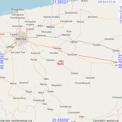
Huhi GPS coordinates[2]
20° 43' 33.708" North, 89° 9' 38.592" West
| Map corner | latitude | longitude |
|---|---|---|
| Upper-left | 21.38221°, | -89.86385° |
| Center: | 20.72603°, | -89.16072° |
| Lower-right: | 20.06699°, | -88.4576° |
| Map W x H: | 146.2×146.2 km | = 90.8×90.8mi |
| max Lat: | 32.7° ⇑27.9% North |
| Huhi: | 20.72603° |
| min Lat: | ⇓72.1% South 14.53588° |
| min Long | Huhi | max Long |
| -117.105° | -89.16072° | -86.73105° |
| W 98.6%⇐ | ⇒1.4% E |
Elevation
Elevation of Huhi is 15 m = 49 ft, and this is 1238.7 m = 4064 ft below average elevation for this country.
| Max E: |
3497 m = 11473 ft | 94% |
| Avg. | 1253.7 m = 4113 ft | |
| Huhi | 15 m = 49 ft | |
Min E: |
-1 m = -3 ft | 6% |
See also: Mexico elevation on elevation.city.
Geographical zone
Huhi is located in North Torrid zone (between Equator and Tropic of Cancer). Distance of this Northern Tropic circle is 301.4 km =187.3 mi to North.| Distance of | km | miles | from Huhi |
|---|---|---|---|
| North Pole | 7702.5 | 4786.1 | to North |
| Arctic Circle | 5096.7 | 3166.9 | to North |
| Tropic Cancer | 301.4 | 187.3 | to North |
| Equator | 2304.5 | 1431.9 | to South |


Nearby cities:
15 places around Huhi: (largest is in red/bold)
• Cuzama
16.4 km =10.2 mi,  276°
276°
• Eknakan
22 km =13.7 mi, 279°
• Hocaba
13.4 km =8.3 mi,  318°
318°
• Hoctun
16 km =9.9 mi,  344°
344°
• Homun
13 km =8.1 mi, 276°
• Kantunil
15.2 km =9.4 mi,  58°
58°
• Sahcaba
7.6 km =4.7 mi, 343°
• San Isidro Ochil
21.4 km =13.3 mi,  242°
242°
• San José Oriente
16.1 km =10 mi,  22°
22°
• Sanahcat
7.5 km =4.7 mi,  312°
312°
• Sotuta
21.4 km =13.3 mi,  132°
132°
• Tahmek
19.1 km =11.9 mi,  329°
329°
• Xanabá
19.6 km =12.2 mi,  51°
51°
• Xocchel
12.2 km =7.6 mi,  348°
348°
• Zavala
13.8 km =8.6 mi,  159°
159°
Sources, notices
• [Note1] Compared only with cities in Mexico existing in our database
• [Src1] Map data: © OpenStreetMap contributors (CC-BY-SA)
• [Src2] Other city data from geonames.org with taken over terms of usage.
• [Src3] Geographical zone / Annual Mean Temperature by Robert A. Rohde @ Wikipedia
