Sotuta geodata
Sotuta (Yucatán) is a seat of a second-order administrative division; located in Mexico in America/Merida (GMT-6) time zone. With population of 5,548 people, there are 1683 cities with bigger population in this country. Compared to other cities in Mexico, 69.9% of cities are located further ↓South; 98.8% of cities are located further ←West and 92.1% of cities have higher elevation than Sotuta. Note1


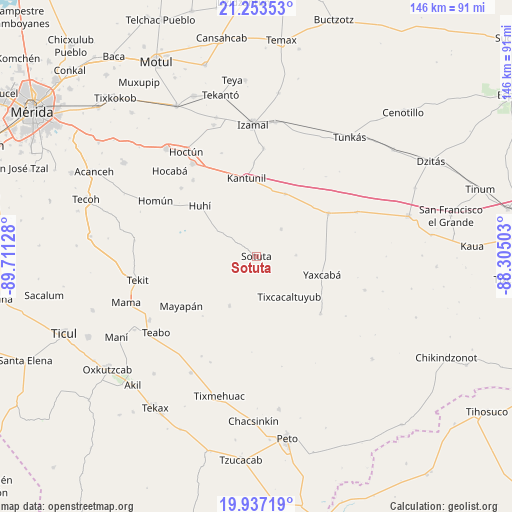
Sotuta GPS coordinates[2]
20° 35' 48.408" North, 89° 0' 29.34" West
| Map corner | latitude | longitude |
|---|---|---|
| Upper-left | 21.25353°, | -89.71128° |
| Center: | 20.59678°, | -89.00815° |
| Lower-right: | 19.93719°, | -88.30503° |
| Map W x H: | 146.4×146.4 km | = 91×91mi |
| max Lat: | 32.7° ⇑30.1% North |
| Sotuta: | 20.59678° |
| min Lat: | ⇓69.9% South 14.53588° |
| min Long | Sotuta | max Long |
| -117.105° | -89.00815° | -86.73105° |
| W 98.8%⇐ | ⇒1.2% E |
Elevation
Elevation of Sotuta is 19 m = 62 ft, and this is 1234.7 m = 4051 ft below average elevation for this country.
| Max E: |
3497 m = 11473 ft | 92.1% |
| Avg. | 1253.7 m = 4113 ft | |
| Sotuta | 19 m = 62 ft | |
Min E: |
-1 m = -3 ft | 7.9% |
See also: Mexico elevation on elevation.city.
Geographical zone
Sotuta is located in North Torrid zone (between Equator and Tropic of Cancer). Distance of this Northern Tropic circle is 315.8 km =196.2 mi to North.| Distance of | km | miles | from Sotuta |
|---|---|---|---|
| North Pole | 7716.9 | 4795.1 | to North |
| Arctic Circle | 5111 | 3175.8 | to North |
| Tropic Cancer | 315.8 | 196.2 | to North |
| Equator | 2290.1 | 1423 | to South |


Nearby cities:
15 places around Sotuta: (largest is in red/bold)
• Cantamayec
16.1 km =10 mi,  208°
208°
• Holca
19.6 km =12.2 mi,  24°
24°
• Huhi
21.4 km =13.3 mi,  312°
312°
• Kantunil
22.4 km =13.9 mi,  352°
352°
• Libre Unión
24 km =14.9 mi,  59°
59°
• Mayapan
25.7 km =16 mi,  236°
236°
• Sahcaba
28.2 km =17.5 mi,  320°
320°
• Sanahcat
28.9 km =18 mi, 312°
• Tabi
11.4 km =7.1 mi,  88°
88°
• Tahdzibichen
24.7 km =15.3 mi,  131°
131°
• Tibolón
10.5 km =6.5 mi,  43°
43°
• Tixcacaltuyub
15 km =9.3 mi,  140°
140°
• Xanabá
26.6 km =16.5 mi,  358°
358°
• Yaxcabá
19.6 km =12.2 mi,  105°
105°
• Zavala
11.2 km =7 mi,  277°
277°
Sources, notices
• [Note1] Compared only with cities in Mexico existing in our database
• [Src1] Map data: © OpenStreetMap contributors (CC-BY-SA)
• [Src2] Other city data from geonames.org with taken over terms of usage.
• [Src3] Geographical zone / Annual Mean Temperature by Robert A. Rohde @ Wikipedia
