Huehuetla geodata
Huehuetla (Puebla) is a seat of a second-order administrative division; located in Mexico in America/Mexico_City (GMT-6) time zone. With population of 1,764 people, there are 4921 cities with bigger population in this country. Compared to other cities in Mexico, 59.3% of cities are located further ↓South; 68.1% of cities are located further ←West and 67.7% of cities have higher elevation than Huehuetla. Note1


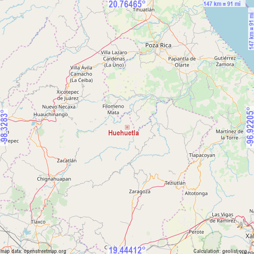
Huehuetla GPS coordinates[2]
20° 6' 20.808" North, 97° 37' 30.612" West
| Map corner | latitude | longitude |
|---|---|---|
| Upper-left | 20.76465°, | -98.3283° |
| Center: | 20.10578°, | -97.62517° |
| Lower-right: | 19.44412°, | -96.92205° |
| Map W x H: | 146.8×146.8 km | = 91.2×91.2mi |
| max Lat: | 32.7° ⇑40.7% North |
| Huehuetla: | 20.10578° |
| min Lat: | ⇓59.3% South 14.53588° |
| min Long | Huehuetla | max Long |
| -117.105° | -97.62517° | -86.73105° |
| W 68.1%⇐ | ⇒31.9% E |
Elevation
Elevation of Huehuetla is 545 m = 1788 ft, and this is 708.7 m = 2325 ft below average elevation for this country.
| Max E: |
3497 m = 11473 ft | 67.7% |
| Avg. | 1253.7 m = 4113 ft | |
| Huehuetla | 545 m = 1788 ft | |
Min E: |
-1 m = -3 ft | 32.3% |
See also: Mexico elevation on elevation.city.
Geographical zone
Huehuetla is located in North Torrid zone (between Equator and Tropic of Cancer). Distance of this Northern Tropic circle is 370.4 km =230.2 mi to North.| Distance of | km | miles | from Huehuetla |
|---|---|---|---|
| North Pole | 7771.5 | 4829 | to North |
| Arctic Circle | 5165.6 | 3209.8 | to North |
| Tropic Cancer | 370.4 | 230.2 | to North |
| Equator | 2235.6 | 1389.1 | to South |


Nearby cities:
15 places around Huehuetla: (largest is in red/bold)
• Acatzácatl
4.3 km =2.7 mi,  82°
82°
• Caxhuacán
5.1 km =3.2 mi,  157°
157°
• Chilocoyo del Carmen
4.2 km =2.6 mi,  227°
227°
• Cinco de Mayo
2.9 km =1.8 mi,  350°
350°
• Francisco I. Madero
2.7 km =1.7 mi,  87°
87°
• Kuwik Chuchut
1.7 km =1.1 mi,  64°
64°
• Lacapan Camallagne
3.9 km =2.4 mi,  310°
310°
• Leacaman
2 km =1.2 mi,  246°
246°
• Lipuntahuaca
1.7 km =1.1 mi,  198°
198°
• Pumacachocochuchut
2.6 km =1.6 mi,  296°
296°
• Putaxcat
1.4 km =0.9 mi,  179°
179°
• Putlunichuchut (Vista Hermosa)
5.7 km =3.5 mi,  10°
10°
• Santa Catarina
5.3 km =3.3 mi,  323°
323°
• Vicente Guerrero
3.6 km =2.2 mi, 302°
• Xonalpu
2.9 km =1.8 mi,  31°
31°
Sources, notices
• [Note1] Compared only with cities in Mexico existing in our database
• [Src1] Map data: © OpenStreetMap contributors (CC-BY-SA)
• [Src2] Other city data from geonames.org with taken over terms of usage.
• [Src3] Geographical zone / Annual Mean Temperature by Robert A. Rohde @ Wikipedia
