Huapango geodata
Huapango (State of Mexico) is a populated place; located in Mexico in America/Mexico_City (GMT-6) time zone. With population of 505 people, there are 16660 cities with bigger population in this country. Compared to other cities in Mexico, 56.5% of cities are located further ↓South; 60.1% of cities are located further →East and 96.7% of cities have lower elevation than Huapango. Note1


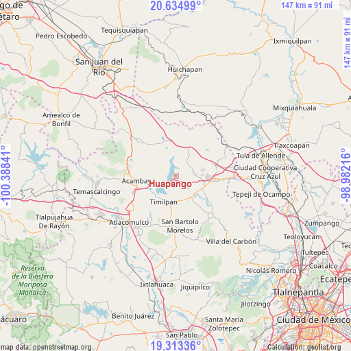
Huapango GPS coordinates[2]
19° 58' 32.016" North, 99° 41' 7.008" West
| Map corner | latitude | longitude |
|---|---|---|
| Upper-left | 20.63499°, | -100.38841° |
| Center: | 19.97556°, | -99.68528° |
| Lower-right: | 19.31336°, | -98.98216° |
| Map W x H: | 147×147 km | = 91.3×91.3mi |
| max Lat: | 32.7° ⇑43.5% North |
| Huapango: | 19.97556° |
| min Lat: | ⇓56.5% South 14.53588° |
| min Long | Huapango | max Long |
| -117.105° | -99.68528° | -86.73105° |
| W 39.9%⇐ | ⇒60.1% E |
Elevation
Elevation of Huapango is 2666 m = 8747 ft, and this is 1412.3 m = 4634 ft above average elevation for this country.
| Max E: |
3497 m = 11473 ft | 3.3% |
| Huapango | 2666 m 8747 ft | |
| Avg. | 1253.7 m = 4113 ft | |
Min E: |
-1 m = -3 ft | 96.7% |
See also: Mexico elevation on elevation.city.
Geographical zone
Huapango is located in North Torrid zone (between Equator and Tropic of Cancer). Distance of this Northern Tropic circle is 384.8 km =239.1 mi to North.| Distance of | km | miles | from Huapango |
|---|---|---|---|
| North Pole | 7786 | 4838 | to North |
| Arctic Circle | 5180.1 | 3218.8 | to North |
| Tropic Cancer | 384.8 | 239.1 | to North |
| Equator | 2221.1 | 1380.1 | to South |


Nearby cities:
15 places around Huapango: (largest is in red/bold)
• Canalejas
8.3 km =5.2 mi,  87°
87°
• El Barrete
7.1 km =4.4 mi, 93°
• El Palmito
6.5 km =4 mi,  176°
176°
• El Rincón
4.1 km =2.5 mi,  119°
119°
• El Saltillo
5.3 km =3.3 mi,  6°
6°
• Las Arenas (San Agustín)
4.9 km =3 mi,  289°
289°
• Los Pilares
4.9 km =3 mi,  313°
313°
• Magueycitos
6.3 km =3.9 mi, 119°
• Octeyuco Dos Mil
10.3 km =6.4 mi,  97°
97°
• San Gabriel
10.5 km =6.5 mi,  156°
156°
• San Juanico Sector Uno
9.8 km =6.1 mi,  242°
242°
• San Lorenzo Octeyuco
8.9 km =5.5 mi, 100°
• San Vicente (Calpulalpan Tercera Manzana)
8.2 km =5.1 mi,  33°
33°
• Teupan (Piedras Negras)
4.2 km =2.6 mi,  197°
197°
• Xhimojay
7.5 km =4.7 mi,  143°
143°
Sources, notices
• [Note1] Compared only with cities in Mexico existing in our database
• [Src1] Map data: © OpenStreetMap contributors (CC-BY-SA)
• [Src2] Other city data from geonames.org with taken over terms of usage.
• [Src3] Geographical zone / Annual Mean Temperature by Robert A. Rohde @ Wikipedia
