Xhimojay geodata
Xhimojay (State of Mexico) is a populated place; located in Mexico in America/Mexico_City (GMT-6) time zone. With population of 2,503 people, there are 3528 cities with bigger population in this country. Compared to other cities in Mexico, 55.5% of cities are located further ↓South; 59.3% of cities are located further →East and 96.7% of cities have lower elevation than Xhimojay. Note1


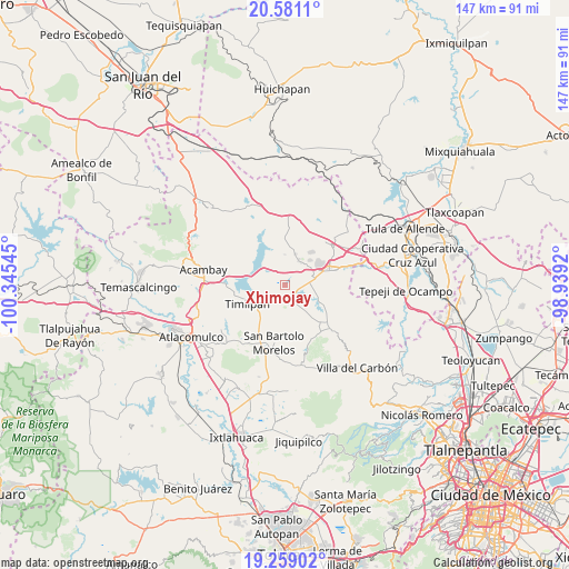
Xhimojay GPS coordinates[2]
19° 55' 17.184" North, 99° 38' 32.352" West
| Map corner | latitude | longitude |
|---|---|---|
| Upper-left | 20.5811°, | -100.34545° |
| Center: | 19.92144°, | -99.64232° |
| Lower-right: | 19.25902°, | -98.9392° |
| Map W x H: | 147×147 km | = 91.3×91.3mi |
| max Lat: | 32.7° ⇑44.5% North |
| Xhimojay: | 19.92144° |
| min Lat: | ⇓55.5% South 14.53588° |
| min Long | Xhimojay | max Long |
| -117.105° | -99.64232° | -86.73105° |
| W 40.7%⇐ | ⇒59.3% E |
Elevation
Elevation of Xhimojay is 2662 m = 8734 ft, and this is 1408.3 m = 4620 ft above average elevation for this country.
| Max E: |
3497 m = 11473 ft | 3.3% |
| Xhimojay | 2662 m 8734 ft | |
| Avg. | 1253.7 m = 4113 ft | |
Min E: |
-1 m = -3 ft | 96.7% |
See also: Mexico elevation on elevation.city.
Geographical zone
Xhimojay is located in North Torrid zone (between Equator and Tropic of Cancer). Distance of this Northern Tropic circle is 390.9 km =242.9 mi to North.| Distance of | km | miles | from Xhimojay |
|---|---|---|---|
| North Pole | 7792 | 4841.7 | to North |
| Arctic Circle | 5186.1 | 3222.5 | to North |
| Tropic Cancer | 390.9 | 242.9 | to North |
| Equator | 2215.1 | 1376.4 | to South |


Nearby cities:
15 places around Xhimojay: (largest is in red/bold)
• Canalejas
7.4 km =4.6 mi,  31°
31°
• El Barrete
6.2 km =3.9 mi, 25°
• El Durazno de Cuauhtémoc
4 km =2.5 mi,  103°
103°
• El Magueyal
7.5 km =4.7 mi,  71°
71°
• El Palmito
4.1 km =2.5 mi,  263°
263°
• El Puerto
4.8 km =3 mi,  192°
192°
• El Rincón
4.1 km =2.5 mi,  346°
346°
• Huapango
7.5 km =4.7 mi,  323°
323°
• Magueycitos
3 km =1.9 mi,  19°
19°
• Octeyuco Dos Mil
7.3 km =4.5 mi,  50°
50°
• Primera Manzana del Pueblo de Rincón de Bucio
7 km =4.3 mi,  223°
223°
• San Gabriel
3.7 km =2.3 mi, 186°
• San Juan Tuxtepec
7.1 km =4.4 mi,  171°
171°
• San Lorenzo Octeyuco
6.1 km =3.8 mi,  43°
43°
• Teupan (Piedras Negras)
6.1 km =3.8 mi,  288°
288°
Sources, notices
• [Note1] Compared only with cities in Mexico existing in our database
• [Src1] Map data: © OpenStreetMap contributors (CC-BY-SA)
• [Src2] Other city data from geonames.org with taken over terms of usage.
• [Src3] Geographical zone / Annual Mean Temperature by Robert A. Rohde @ Wikipedia
