Las Arenas (San Agustín) geodata
Las Arenas (San Agustín) (State of Mexico) is a populated place; located in Mexico in America/Mexico_City (GMT-6) time zone. With population of 767 people, there are 11411 cities with bigger population in this country. Compared to other cities in Mexico, 56.8% of cities are located further ↓South; 60.6% of cities are located further →East and 96.2% of cities have lower elevation than Las Arenas (San Agustín). Note1
Current local time in Las Arenas (San Agustín):
10:02 AM, MondayDifference from your time zone: hours


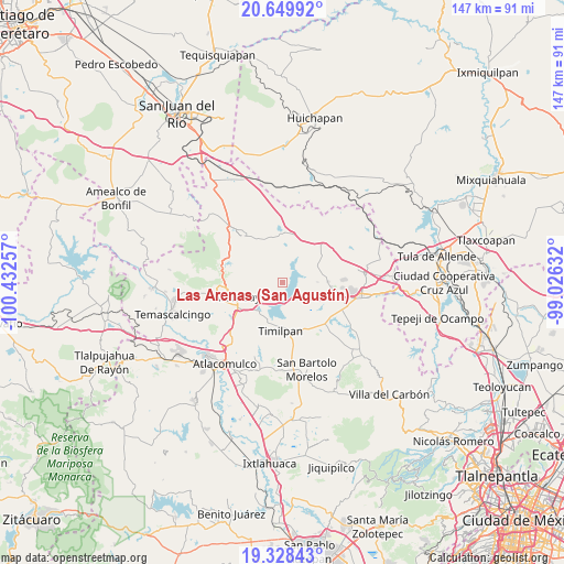
Las Arenas (San Agustín) GPS coordinates[2]
19° 59' 26.016" North, 99° 43' 45.984" West
| Map corner | latitude | longitude |
|---|---|---|
| Upper-left | 20.64992°, | -100.43257° |
| Center: | 19.99056°, | -99.72944° |
| Lower-right: | 19.32843°, | -99.02632° |
| Map W x H: | 146.9×146.9 km | = 91.3×91.3mi |
| max Lat: | 32.7° ⇑43.2% North |
| Las Arenas (San Agustín): | 19.99056° |
| min Lat: | ⇓56.8% South 14.53588° |
| min Long | Las Arenas (San | max Long |
| -117.105° | -99.72944° | -86.73105° |
| W 39.4%⇐ | ⇒60.6% E |
Elevation
Elevation of Las Arenas (San Agustín) is 2635 m = 8645 ft, and this is 1381.3 m = 4532 ft above average elevation for this country.
| Max E: |
3497 m = 11473 ft | 3.8% |
| Las Arenas (San Agustín) | 2635 m 8645 ft | |
| Avg. | 1253.7 m = 4113 ft | |
Min E: |
-1 m = -3 ft | 96.2% |
See also: Mexico elevation on elevation.city.
Geographical zone
Las Arenas (San Agustín) is located in North Torrid zone (between Equator and Tropic of Cancer). Distance of this Northern Tropic circle is 383.2 km =238.1 mi to North.| Distance of | km | miles | from Las Arenas (San Agustín) |
|---|---|---|---|
| North Pole | 7784.3 | 4836.9 | to North |
| Arctic Circle | 5178.4 | 3217.7 | to North |
| Tropic Cancer | 383.2 | 238.1 | to North |
| Equator | 2222.7 | 1381.1 | to South |


Nearby cities:
15 places around Las Arenas (San Agustín): (largest is in red/bold)
• Buenavista
7.4 km =4.6 mi,  285°
285°
• El Bonxhi
9.5 km =5.9 mi,  353°
353°
• El Palmito
9.6 km =6 mi,  148°
148°
• El Rincón
9 km =5.6 mi,  114°
114°
• El Saltillo
6.4 km =4 mi,  55°
55°
• Fondo
8.6 km =5.3 mi,  333°
333°
• Huapango
4.9 km =3 mi, 109°
• La Venta (Barrio la Venta)
9 km =5.6 mi,  213°
213°
• Loma Linda
9.9 km =6.2 mi,  283°
283°
• Los Pilares
2 km =1.2 mi,  30°
30°
• San Juanico Sector Dos
8.2 km =5.1 mi,  224°
224°
• San Juanico Sector Uno
7.4 km =4.6 mi, 212°
• San Martín Ejido
9.7 km =6 mi,  22°
22°
• San Vicente (Calpulalpan Tercera Manzana)
10.5 km =6.5 mi, 60°
• Teupan (Piedras Negras)
6.6 km =4.1 mi, 149°
Sources, notices
• [Note1] Compared only with cities in Mexico existing in our database
• [Src1] Map data: © OpenStreetMap contributors (CC-BY-SA)
• [Src2] Other city data from geonames.org with taken over terms of usage.
• [Src3] Geographical zone / Annual Mean Temperature by Robert A. Rohde @ Wikipedia
