Guadalupe Victoria geodata
Guadalupe Victoria (Chiapas) is a populated place; located in Mexico in America/Mexico_City (GMT-6) time zone. With population of 851 people, there are 10275 cities with bigger population in this country. Compared to other cities in Mexico, 97.2% of cities are located further ↑North; 89.2% of cities are located further ←West and 66.9% of cities have higher elevation than Guadalupe Victoria. Note1


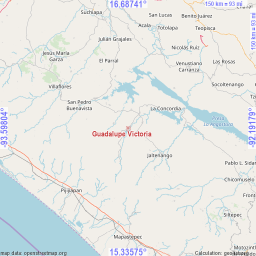
Guadalupe Victoria GPS coordinates[2]
16° 0' 45.792" North, 92° 53' 41.676" West
| Map corner | latitude | longitude |
|---|---|---|
| Upper-left | 16.68741°, | -93.59804° |
| Center: | 16.01272°, | -92.89491° |
| Lower-right: | 15.33575°, | -92.19179° |
| Map W x H: | 150.3×150.3 km | = 93.4×93.4mi |
| max Lat: | 32.7° ⇑97.2% North |
| Guadalupe Victoria: | 16.01272° |
| min Lat: | ⇓2.8% South 14.53588° |
| min Long | Guadalupe Victo | max Long |
| -117.105° | -92.89491° | -86.73105° |
| W 89.2%⇐ | ⇒10.8% E |
Elevation
Elevation of Guadalupe Victoria is 588 m = 1929 ft, and this is 665.7 m = 2184 ft below average elevation for this country.
| Max E: |
3497 m = 11473 ft | 66.9% |
| Avg. | 1253.7 m = 4113 ft | |
| Guadalupe Victoria | 588 m = 1929 ft | |
Min E: |
-1 m = -3 ft | 33.1% |
See also: Mexico elevation on elevation.city.
Geographical zone
Guadalupe Victoria is located in North Torrid zone (between Equator and Tropic of Cancer). Distance of this Northern Tropic circle is 825.5 km =512.9 mi to North.| Distance of | km | miles | from Guadalupe Victoria |
|---|---|---|---|
| North Pole | 8226.6 | 5111.8 | to North |
| Arctic Circle | 5620.7 | 3492.5 | to North |
| Tropic Cancer | 825.5 | 512.9 | to North |
| Equator | 1780.4 | 1106.3 | to South |


Nearby cities:
15 places around Guadalupe Victoria: (largest is in red/bold)
• Benito Juárez
8.8 km =5.5 mi,  67°
67°
• Diamante de Echeverría
11.1 km =6.9 mi,  8°
8°
• Dolores Jaltenango
18 km =11.2 mi,  135°
135°
• El Ramal (Porvenir)
17.2 km =10.7 mi,  198°
198°
• El Ámbar (El Ámbar de Echeverría)
11.4 km =7.1 mi,  35°
35°
• Embarcadero de Jericó (El Siglo)
21.3 km =13.2 mi,  348°
348°
• Independencia
10.2 km =6.3 mi, 36°
• La Tigrilla
5.3 km =3.3 mi,  121°
121°
• Loma Bonita
22.9 km =14.2 mi,  339°
339°
• Manuel Ávila Camacho
19.8 km =12.3 mi,  318°
318°
• Nueva Libertad
12.7 km =7.9 mi,  47°
47°
• Nuevo Vicente Guerrero
9.1 km =5.7 mi,  288°
288°
• Plan de Agua Prieta
17.2 km =10.7 mi, 40°
• San Nicolás
22.4 km =13.9 mi,  126°
126°
• Santiago
19 km =11.8 mi, 317°
Sources, notices
• [Note1] Compared only with cities in Mexico existing in our database
• [Src1] Map data: © OpenStreetMap contributors (CC-BY-SA)
• [Src2] Other city data from geonames.org with taken over terms of usage.
• [Src3] Geographical zone / Annual Mean Temperature by Robert A. Rohde @ Wikipedia
