Diamante de Echeverría geodata
Diamante de Echeverría (Chiapas) is a populated place; located in Mexico in America/Mexico_City (GMT-6) time zone. With population of 2,157 people, there are 4074 cities with bigger population in this country. Compared to other cities in Mexico, 96.8% of cities are located further ↑North; 89.3% of cities are located further ←West and 67.2% of cities have higher elevation than Diamante de Echeverría. Note1
Current local time in Diamante de Echeverría:
06:45 AM, WednesdayDifference from your time zone: hours


Diamante de Echeverría GPS coordinates[2]
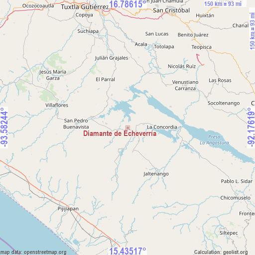
16° 6' 42.516" North, 92° 52' 45.516" West
| Map corner | latitude | longitude |
|---|---|---|
| Upper-left | 16.78615°, | -93.58244° |
| Center: | 16.11181°, | -92.87931° |
| Lower-right: | 15.43517°, | -92.17619° |
| Map W x H: | 150.2×150.2 km | = 93.3×93.3mi |
| max Lat: | 32.7° ⇑96.8% North |
| Diamante de Echeverría: | 16.11181° |
| min Lat: | ⇓3.2% South 14.53588° |
| min Long | Diamante de Ech | max Long |
| -117.105° | -92.87931° | -86.73105° |
| W 89.3%⇐ | ⇒10.7% E |
Elevation
Elevation of Diamante de Echeverría is 577 m = 1893 ft, and this is 676.7 m = 2220 ft below average elevation for this country.
| Max E: |
3497 m = 11473 ft | 67.2% |
| Avg. | 1253.7 m = 4113 ft | |
| Diamante de Echeverría | 577 m = 1893 ft | |
Min E: |
-1 m = -3 ft | 32.8% |
See also: Mexico elevation on elevation.city.
Geographical zone
Diamante de Echeverría is located in North Torrid zone (between Equator and Tropic of Cancer). Distance of this Northern Tropic circle is 814.5 km =506.1 mi to North.| Distance of | km | miles | from Diamante de Echeverría |
|---|---|---|---|
| North Pole | 8215.6 | 5104.9 | to North |
| Arctic Circle | 5609.7 | 3485.7 | to North |
| Tropic Cancer | 814.5 | 506.1 | to North |
| Equator | 1791.5 | 1113.2 | to South |


Nearby cities:
15 places around Diamante de Echeverría: (largest is in red/bold)
• Benito Juárez
10 km =6.2 mi,  139°
139°
• El Ámbar (El Ámbar de Echeverría)
5.2 km =3.2 mi,  109°
109°
• Embarcadero de Jericó (El Siglo)
11.6 km =7.2 mi,  328°
328°
• Guadalupe Victoria
11.1 km =6.9 mi,  188°
188°
• Independencia
5.2 km =3.2 mi,  123°
123°
• Jericó
21.6 km =13.4 mi, 334°
• La Concordia
20.2 km =12.6 mi,  88°
88°
• La Tigrilla
14.1 km =8.8 mi,  168°
168°
• Loma Bonita
14.3 km =8.9 mi,  316°
316°
• Manuel Ávila Camacho
15.2 km =9.4 mi,  284°
284°
• Nueva Libertad
8 km =5 mi, 107°
• Nuevo Vicente Guerrero
13.1 km =8.1 mi,  231°
231°
• Plan de Agua Prieta
9.6 km =6 mi,  77°
77°
• Revolución Mexicana
22.1 km =13.7 mi,  287°
287°
• Santiago
14.8 km =9.2 mi, 281°
Sources, notices
• [Note1] Compared only with cities in Mexico existing in our database
• [Src1] Map data: © OpenStreetMap contributors (CC-BY-SA)
• [Src2] Other city data from geonames.org with taken over terms of usage.
• [Src3] Geographical zone / Annual Mean Temperature by Robert A. Rohde @ Wikipedia
