El Paredón geodata
El Paredón (Hidalgo) is a populated place; located in Mexico in America/Mexico_City (GMT-6) time zone. With population of 2,413 people, there are 3654 cities with bigger population in this country. Compared to other cities in Mexico, 54.4% of cities are located further ↓South; 60.5% of cities are located further ←West and 95.9% of cities have lower elevation than El Paredón. Note1


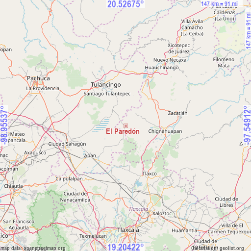
El Paredón GPS coordinates[2]
19° 52' 0.696" North, 98° 15' 8.064" West
| Map corner | latitude | longitude |
|---|---|---|
| Upper-left | 20.52675°, | -98.95537° |
| Center: | 19.86686°, | -98.25224° |
| Lower-right: | 19.20422°, | -97.54912° |
| Map W x H: | 147.1×147.1 km | = 91.4×91.4mi |
| max Lat: | 32.7° ⇑45.6% North |
| El Paredón: | 19.86686° |
| min Lat: | ⇓54.4% South 14.53588° |
| min Long | El Paredón | max Long |
| -117.105° | -98.25224° | -86.73105° |
| W 60.5%⇐ | ⇒39.5% E |
Elevation
Elevation of El Paredón is 2623 m = 8606 ft, and this is 1369.3 m = 4492 ft above average elevation for this country.
| Max E: |
3497 m = 11473 ft | 4.1% |
| El Paredón | 2623 m 8606 ft | |
| Avg. | 1253.7 m = 4113 ft | |
Min E: |
-1 m = -3 ft | 95.9% |
See also: Mexico elevation on elevation.city.
Geographical zone
El Paredón is located in North Torrid zone (between Equator and Tropic of Cancer). Distance of this Northern Tropic circle is 396.9 km =246.6 mi to North.| Distance of | km | miles | from El Paredón |
|---|---|---|---|
| North Pole | 7798.1 | 4845.5 | to North |
| Arctic Circle | 5192.2 | 3226.3 | to North |
| Tropic Cancer | 396.9 | 246.6 | to North |
| Equator | 2209 | 1372.6 | to South |


Nearby cities:
15 places around El Paredón: (largest is in red/bold)
• Acolihuia
16.2 km =10.1 mi,  124°
124°
• Cuautelolulco
12.4 km =7.7 mi,  75°
75°
• El Aserradero
12.5 km =7.8 mi,  322°
322°
• El Capulín
16 km =9.9 mi,  351°
351°
• Los Ranchos (Rinconada)
17.3 km =10.7 mi,  159°
159°
• Pueblo Nuevo (Peñuelas)
17.7 km =11 mi,  56°
56°
• Rancho Nuevo
13.5 km =8.4 mi,  192°
192°
• San Francisco Terrerillos
10.4 km =6.5 mi, 62°
• San José Corral Blanco
9 km =5.6 mi, 58°
• San Lorenzo Sayula
14.4 km =8.9 mi,  340°
340°
• Santa Ana Chichicuautla
16.4 km =10.2 mi,  294°
294°
• Santa Elena Paliseca
14.6 km =9.1 mi,  4°
4°
• Tecocomulco de Juárez
11.3 km =7 mi, 292°
• Tezoncualpan
11.2 km =7 mi, 347°
• Tres Cabezas
3 km =1.9 mi,  302°
302°
Sources, notices
• [Note1] Compared only with cities in Mexico existing in our database
• [Src1] Map data: © OpenStreetMap contributors (CC-BY-SA)
• [Src2] Other city data from geonames.org with taken over terms of usage.
• [Src3] Geographical zone / Annual Mean Temperature by Robert A. Rohde @ Wikipedia
