Pueblo Nuevo (Peñuelas) geodata
Pueblo Nuevo (Peñuelas) (Puebla) is a populated place; located in Mexico in America/Mexico_City (GMT-6) time zone. With population of 530 people, there are 15970 cities with bigger population in this country. Compared to other cities in Mexico, 56.1% of cities are located further ↓South; 62.4% of cities are located further ←West and 96.8% of cities have lower elevation than Pueblo Nuevo (Peñuelas). Note1
Current local time in Pueblo Nuevo (Peñuelas):
08:32 AM, WednesdayDifference from your time zone: hours


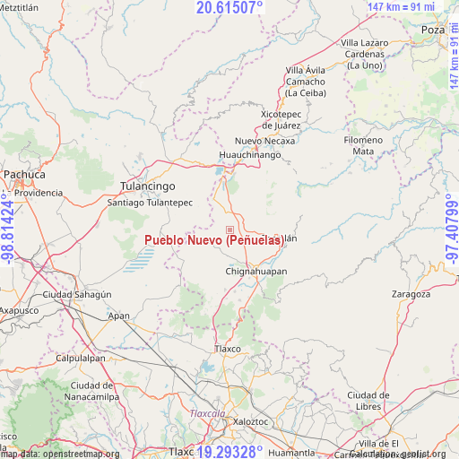
Pueblo Nuevo (Peñuelas) GPS coordinates[2]
19° 57' 20.016" North, 98° 6' 39.996" West
| Map corner | latitude | longitude |
|---|---|---|
| Upper-left | 20.61507°, | -98.81424° |
| Center: | 19.95556°, | -98.11111° |
| Lower-right: | 19.29328°, | -97.40799° |
| Map W x H: | 147×147 km | = 91.3×91.3mi |
| max Lat: | 32.7° ⇑43.9% North |
| Pueblo Nuevo (Peñuelas): | 19.95556° |
| min Lat: | ⇓56.1% South 14.53588° |
| min Long | Pueblo Nuevo (P | max Long |
| -117.105° | -98.11111° | -86.73105° |
| W 62.4%⇐ | ⇒37.6% E |
Elevation
Elevation of Pueblo Nuevo (Peñuelas) is 2670 m = 8760 ft, and this is 1416.3 m = 4647 ft above average elevation for this country.
| Max E: |
3497 m = 11473 ft | 3.2% |
| Pueblo Nuevo (Peñuelas) | 2670 m 8760 ft | |
| Avg. | 1253.7 m = 4113 ft | |
Min E: |
-1 m = -3 ft | 96.8% |
See also: Mexico elevation on elevation.city.
Geographical zone
Pueblo Nuevo (Peñuelas) is located in North Torrid zone (between Equator and Tropic of Cancer). Distance of this Northern Tropic circle is 387.1 km =240.5 mi to North.| Distance of | km | miles | from Pueblo Nuevo (Peñuelas) |
|---|---|---|---|
| North Pole | 7788.2 | 4839.4 | to North |
| Arctic Circle | 5182.3 | 3220.1 | to North |
| Tropic Cancer | 387.1 | 240.5 | to North |
| Equator | 2218.9 | 1378.8 | to South |


Nearby cities:
15 places around Pueblo Nuevo (Peñuelas): (largest is in red/bold)
• Ahuazotepec
11.4 km =7.1 mi,  331°
331°
• Atotonilco
5.4 km =3.4 mi,  335°
335°
• Ayotla
8.4 km =5.2 mi,  117°
117°
• Camotepec
11.1 km =6.9 mi,  23°
23°
• Cuautelolulco
7.3 km =4.5 mi,  201°
201°
• La Estación de Ahuazotepec
11.3 km =7 mi, 338°
• Laguna Seca
9.5 km =5.9 mi,  351°
351°
• Las Lajas
6.2 km =3.9 mi,  39°
39°
• Las Lajas Primera Sección
6.2 km =3.9 mi, 20°
• Matlahuacala
8.2 km =5.1 mi,  97°
97°
• Metepec
6.4 km =4 mi,  59°
59°
• Nanacamila
6.1 km =3.8 mi, 353°
• San Francisco Terrerillos
7.5 km =4.7 mi,  227°
227°
• San José Corral Blanco
8.7 km =5.4 mi, 233°
• Tepoxcuautla
12.6 km =7.8 mi, 117°
Sources, notices
• [Note1] Compared only with cities in Mexico existing in our database
• [Src1] Map data: © OpenStreetMap contributors (CC-BY-SA)
• [Src2] Other city data from geonames.org with taken over terms of usage.
• [Src3] Geographical zone / Annual Mean Temperature by Robert A. Rohde @ Wikipedia
