Cuautelolulco geodata
Cuautelolulco (Puebla) is a populated place; located in Mexico in America/Mexico_City (GMT-6) time zone. With population of 635 people, there are 13639 cities with bigger population in this country. Compared to other cities in Mexico, 54.9% of cities are located further ↓South; 62.1% of cities are located further ←West and 99.2% of cities have lower elevation than Cuautelolulco. Note1


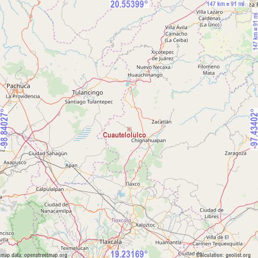
Cuautelolulco GPS coordinates[2]
19° 53' 39.192" North, 98° 8' 13.704" West
| Map corner | latitude | longitude |
|---|---|---|
| Upper-left | 20.55399°, | -98.84027° |
| Center: | 19.89422°, | -98.13714° |
| Lower-right: | 19.23169°, | -97.43402° |
| Map W x H: | 147×147 km | = 91.3×91.3mi |
| max Lat: | 32.7° ⇑45.1% North |
| Cuautelolulco: | 19.89422° |
| min Lat: | ⇓54.9% South 14.53588° |
| min Long | Cuautelolulco | max Long |
| -117.105° | -98.13714° | -86.73105° |
| W 62.1%⇐ | ⇒37.9% E |
Elevation
Elevation of Cuautelolulco is 2862 m = 9390 ft, and this is 1608.3 m = 5277 ft above average elevation for this country.
| Max E: |
3497 m = 11473 ft | 0.8% |
| Cuautelolulco | 2862 m 9390 ft | |
| Avg. | 1253.7 m = 4113 ft | |
Min E: |
-1 m = -3 ft | 99.2% |
See also: Mexico elevation on elevation.city.
Geographical zone
Cuautelolulco is located in North Torrid zone (between Equator and Tropic of Cancer). Distance of this Northern Tropic circle is 393.9 km =244.8 mi to North.| Distance of | km | miles | from Cuautelolulco |
|---|---|---|---|
| North Pole | 7795 | 4843.6 | to North |
| Arctic Circle | 5189.1 | 3224.4 | to North |
| Tropic Cancer | 393.9 | 244.8 | to North |
| Equator | 2212 | 1374.5 | to South |


Nearby cities:
15 places around Cuautelolulco: (largest is in red/bold)
• Acolihuia
12.3 km =7.6 mi,  174°
174°
• Atotonilco
11.7 km =7.3 mi,  2°
2°
• Ayotla
10.6 km =6.6 mi,  73°
73°
• Chignahuapan
12.6 km =7.8 mi,  119°
119°
• El Paredón
12.4 km =7.7 mi,  255°
255°
• Las Lajas
13.4 km =8.3 mi,  29°
29°
• Lázaro Cárdenas (Tzitla)
12.3 km =7.6 mi,  134°
134°
• Matlahuacala
12.3 km =7.6 mi,  62°
62°
• Metepec
13 km =8.1 mi,  39°
39°
• Michac
10.1 km =6.3 mi, 117°
• Nanacamila
13 km =8.1 mi,  8°
8°
• Pueblo Nuevo (Peñuelas)
7.3 km =4.5 mi,  21°
21°
• San Francisco Terrerillos
3.3 km =2.1 mi,  302°
302°
• San José Corral Blanco
4.6 km =2.9 mi,  290°
290°
• Villa Cuauhtémoc
13.5 km =8.4 mi,  162°
162°
Sources, notices
• [Note1] Compared only with cities in Mexico existing in our database
• [Src1] Map data: © OpenStreetMap contributors (CC-BY-SA)
• [Src2] Other city data from geonames.org with taken over terms of usage.
• [Src3] Geographical zone / Annual Mean Temperature by Robert A. Rohde @ Wikipedia
