Coyotepec geodata
Coyotepec (State of Mexico) is a seat of a second-order administrative division; located in Mexico in America/Mexico_City (GMT-6) time zone. With population of 35,677 people, there are 285 cities with bigger population in this country. Compared to other cities in Mexico, 52.2% of cities are located further ↓South; 53% of cities are located further →East and 87.4% of cities have lower elevation than Coyotepec. Note1


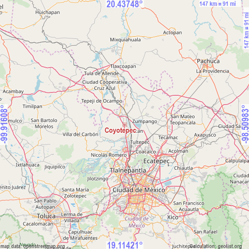
Coyotepec GPS coordinates[2]
19° 46' 37.992" North, 99° 12' 46.62" West
| Map corner | latitude | longitude |
|---|---|---|
| Upper-left | 20.43748°, | -99.91608° |
| Center: | 19.77722°, | -99.21295° |
| Lower-right: | 19.11421°, | -98.50983° |
| Map W x H: | 147.1×147.1 km | = 91.4×91.4mi |
| max Lat: | 32.7° ⇑47.8% North |
| Coyotepec: | 19.77722° |
| min Lat: | ⇓52.2% South 14.53588° |
| min Long | Coyotepec | max Long |
| -117.105° | -99.21295° | -86.73105° |
| W 47%⇐ | ⇒53% E |
Elevation
Elevation of Coyotepec is 2321 m = 7615 ft, and this is 1067.3 m = 3502 ft above average elevation for this country.
| Max E: |
3497 m = 11473 ft | 12.6% |
| Coyotepec | 2321 m 7615 ft | |
| Avg. | 1253.7 m = 4113 ft | |
Min E: |
-1 m = -3 ft | 87.4% |
See also: Mexico elevation on elevation.city.
Geographical zone
Coyotepec is located in North Torrid zone (between Equator and Tropic of Cancer). Distance of this Northern Tropic circle is 406.9 km =252.8 mi to North.| Distance of | km | miles | from Coyotepec |
|---|---|---|---|
| North Pole | 7808 | 4851.7 | to North |
| Arctic Circle | 5202.2 | 3232.5 | to North |
| Tropic Cancer | 406.9 | 252.8 | to North |
| Equator | 2199 | 1366.4 | to South |


Nearby cities:
15 places around Coyotepec: (largest is in red/bold)
• Ampliación los Potros (Tres Piedras)
5.4 km =3.4 mi,  208°
208°
• Barrio Tlatenco
4.8 km =3 mi,  152°
152°
• Barrio la Tecla
2.3 km =1.4 mi,  224°
224°
• Casa Nueva
6.2 km =3.9 mi,  3°
3°
• El Ramal (Las Ladrilleras)
3.2 km =2 mi,  115°
115°
• Ex-hacienda de Xalpa
5.9 km =3.7 mi,  32°
32°
• Huehuetoca
5.7 km =3.5 mi,  9°
9°
• La Planada
3.2 km =2 mi,  81°
81°
• Lumbrera Número Diez
5.3 km =3.3 mi,  193°
193°
• Salitrillo
5.8 km =3.6 mi,  356°
356°
• San Pedro Xalpa
6.2 km =3.9 mi, 28°
• San Sebastián
2.9 km =1.8 mi,  183°
183°
• Santa Cruz del Monte
2 km =1.2 mi,  235°
235°
• Segunda Sección del Barrio de Santiago
1.6 km =1 mi,  257°
257°
• Teoloyucan
5 km =3.1 mi,  137°
137°
Sources, notices
• [Note1] Compared only with cities in Mexico existing in our database
• [Src1] Map data: © OpenStreetMap contributors (CC-BY-SA)
• [Src2] Other city data from geonames.org with taken over terms of usage.
• [Src3] Geographical zone / Annual Mean Temperature by Robert A. Rohde @ Wikipedia
