Huehuetoca geodata
Huehuetoca (State of Mexico) is a populated place; located in Mexico in America/Mexico_City (GMT-6) time zone. With population of 11,948 people, there are 806 cities with bigger population in this country. Compared to other cities in Mexico, 53.5% of cities are located further ↓South; 52.9% of cities are located further →East and 85.1% of cities have lower elevation than Huehuetoca. Note1


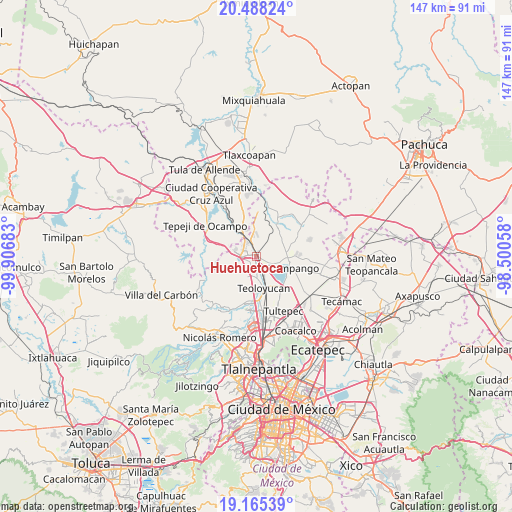
Huehuetoca GPS coordinates[2]
19° 49' 41.484" North, 99° 12' 13.32" West
| Map corner | latitude | longitude |
|---|---|---|
| Upper-left | 20.48824°, | -99.90683° |
| Center: | 19.82819°, | -99.2037° |
| Lower-right: | 19.16539°, | -98.50058° |
| Map W x H: | 147.1×147.1 km | = 91.4×91.4mi |
| max Lat: | 32.7° ⇑46.5% North |
| Huehuetoca: | 19.82819° |
| min Lat: | ⇓53.5% South 14.53588° |
| min Long | Huehuetoca | max Long |
| -117.105° | -99.2037° | -86.73105° |
| W 47.1%⇐ | ⇒52.9% E |
Elevation
Elevation of Huehuetoca is 2261 m = 7418 ft, and this is 1007.3 m = 3305 ft above average elevation for this country.
| Max E: |
3497 m = 11473 ft | 14.9% |
| Huehuetoca | 2261 m 7418 ft | |
| Avg. | 1253.7 m = 4113 ft | |
Min E: |
-1 m = -3 ft | 85.1% |
See also: Mexico elevation on elevation.city.
Geographical zone
Huehuetoca is located in North Torrid zone (between Equator and Tropic of Cancer). Distance of this Northern Tropic circle is 401.2 km =249.3 mi to North.| Distance of | km | miles | from Huehuetoca |
|---|---|---|---|
| North Pole | 7802.4 | 4848.2 | to North |
| Arctic Circle | 5196.5 | 3229 | to North |
| Tropic Cancer | 401.2 | 249.3 | to North |
| Equator | 2204.7 | 1369.9 | to South |


Nearby cities:
15 places around Huehuetoca: (largest is in red/bold)
• Barranca Prieta
3.2 km =2 mi,  341°
341°
• Casa Nueva
0.8 km =0.5 mi,  313°
313°
• Coyotepec
5.7 km =3.5 mi,  189°
189°
• El Ramal (Las Ladrilleras)
7.3 km =4.5 mi,  164°
164°
• Ex-hacienda de Xalpa
2.3 km =1.4 mi,  108°
108°
• Jorobas
4.7 km =2.9 mi,  264°
264°
• La Planada
5.7 km =3.5 mi, 157°
• Praderas del Potrero
6.9 km =4.3 mi, 336°
• Salitrillo
1.3 km =0.8 mi,  275°
275°
• San Bartolo
1.3 km =0.8 mi,  65°
65°
• San Juan Zitlaltepec
6.4 km =4 mi, 106°
• San Pedro Xalpa
2 km =1.2 mi,  94°
94°
• Santa Teresa
3.6 km =2.2 mi,  301°
301°
• Segunda Sección del Barrio de Santiago
6.5 km =4 mi,  202°
202°
• Villa URBI del Rey
5.8 km =3.6 mi, 284°
Sources, notices
• [Note1] Compared only with cities in Mexico existing in our database
• [Src1] Map data: © OpenStreetMap contributors (CC-BY-SA)
• [Src2] Other city data from geonames.org with taken over terms of usage.
• [Src3] Geographical zone / Annual Mean Temperature by Robert A. Rohde @ Wikipedia
