Chiapilla geodata
Chiapilla (Chiapas) is a seat of a second-order administrative division; located in Mexico in America/Mexico_City (GMT-6) time zone. With population of 3,809 people, there are 2399 cities with bigger population in this country. Compared to other cities in Mexico, 93.9% of cities are located further ↑North; 90.4% of cities are located further ←West and 67.7% of cities have higher elevation than Chiapilla. Note1


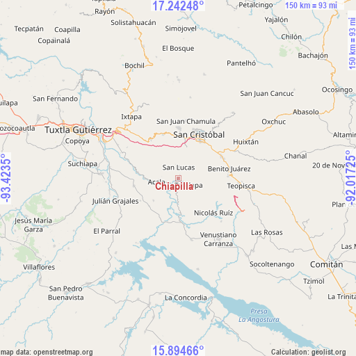
Chiapilla GPS coordinates[2]
16° 34' 11.1" North, 92° 43' 13.332" West
| Map corner | latitude | longitude |
|---|---|---|
| Upper-left | 17.24248°, | -93.4235° |
| Center: | 16.56975°, | -92.72037° |
| Lower-right: | 15.89466°, | -92.01725° |
| Map W x H: | 149.9×149.9 km | = 93.1×93.1mi |
| max Lat: | 32.7° ⇑93.9% North |
| Chiapilla: | 16.56975° |
| min Lat: | ⇓6.1% South 14.53588° |
| min Long | Chiapilla | max Long |
| -117.105° | -92.72037° | -86.73105° |
| W 90.4%⇐ | ⇒9.6% E |
Elevation
Elevation of Chiapilla is 543 m = 1781 ft, and this is 710.7 m = 2332 ft below average elevation for this country.
| Max E: |
3497 m = 11473 ft | 67.7% |
| Avg. | 1253.7 m = 4113 ft | |
| Chiapilla | 543 m = 1781 ft | |
Min E: |
-1 m = -3 ft | 32.3% |
See also: Mexico elevation on elevation.city.
Geographical zone
Chiapilla is located in North Torrid zone (between Equator and Tropic of Cancer). Distance of this Northern Tropic circle is 763.5 km =474.4 mi to North.| Distance of | km | miles | from Chiapilla |
|---|---|---|---|
| North Pole | 8164.7 | 5073.3 | to North |
| Arctic Circle | 5558.8 | 3454.1 | to North |
| Tropic Cancer | 763.5 | 474.4 | to North |
| Equator | 1842.4 | 1144.8 | to South |


Nearby cities:
15 places around Chiapilla: (largest is in red/bold)
• Acala
9.1 km =5.7 mi,  260°
260°
• Francisco Villa
5.1 km =3.2 mi,  62°
62°
• Jechtoch
17.3 km =10.7 mi,  0°
0°
• Laguna del Carmen
8.9 km =5.5 mi,  9°
9°
• Lázaro Cárdenas
4.9 km =3 mi,  248°
248°
• Mariano Matamoros
17.5 km =10.9 mi,  124°
124°
• Pasté
15.1 km =9.4 mi,  351°
351°
• Ponciano Arriaga
13.5 km =8.4 mi,  131°
131°
• San José Buenavista
5.9 km =3.7 mi, 349°
• San Lucas
4.7 km =2.9 mi, 3°
• Shulvo
17 km =10.6 mi,  355°
355°
• Totolapa
5.2 km =3.2 mi, 124°
• Unión Buena Vista
14 km =8.7 mi,  228°
228°
• Vicente Guerrero
14.6 km =9.1 mi,  176°
176°
• Zacualpa Ecatepec
15.4 km =9.6 mi, 9°
Sources, notices
• [Note1] Compared only with cities in Mexico existing in our database
• [Src1] Map data: © OpenStreetMap contributors (CC-BY-SA)
• [Src2] Other city data from geonames.org with taken over terms of usage.
• [Src3] Geographical zone / Annual Mean Temperature by Robert A. Rohde @ Wikipedia
