Zacualpa Ecatepec geodata
Zacualpa Ecatepec (Chiapas) is a populated place; located in Mexico in America/Mexico_City (GMT-6) time zone. With population of 885 people, there are 9853 cities with bigger population in this country. Compared to other cities in Mexico, 92.8% of cities are located further ↑North; 90.5% of cities are located further ←West and 85.3% of cities have lower elevation than Zacualpa Ecatepec. Note1


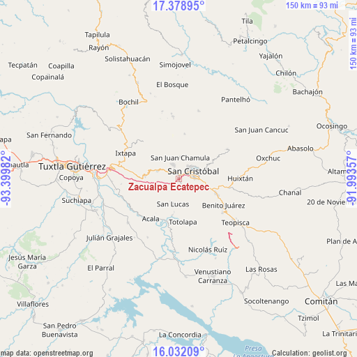
Zacualpa Ecatepec GPS coordinates[2]
16° 42' 24.156" North, 92° 41' 48.084" West
| Map corner | latitude | longitude |
|---|---|---|
| Upper-left | 17.37895°, | -93.39982° |
| Center: | 16.70671°, | -92.69669° |
| Lower-right: | 16.03209°, | -91.99357° |
| Map W x H: | 149.8×149.8 km | = 93.1×93.1mi |
| max Lat: | 32.7° ⇑92.8% North |
| Zacualpa Ecatepec: | 16.70671° |
| min Lat: | ⇓7.2% South 14.53588° |
| min Long | Zacualpa Ecatep | max Long |
| -117.105° | -92.69669° | -86.73105° |
| W 90.5%⇐ | ⇒9.5% E |
Elevation
Elevation of Zacualpa Ecatepec is 2265 m = 7431 ft, and this is 1011.3 m = 3318 ft above average elevation for this country.
| Max E: |
3497 m = 11473 ft | 14.7% |
| Zacualpa Ecatepec | 2265 m 7431 ft | |
| Avg. | 1253.7 m = 4113 ft | |
Min E: |
-1 m = -3 ft | 85.3% |
See also: Mexico elevation on elevation.city.
Geographical zone
Zacualpa Ecatepec is located in North Torrid zone (between Equator and Tropic of Cancer). Distance of this Northern Tropic circle is 748.3 km =465 mi to North.| Distance of | km | miles | from Zacualpa Ecatepec |
|---|---|---|---|
| North Pole | 8149.4 | 5063.8 | to North |
| Arctic Circle | 5543.6 | 3444.6 | to North |
| Tropic Cancer | 748.3 | 465 | to North |
| Equator | 1857.6 | 1154.3 | to South |


Nearby cities:
15 places around Zacualpa Ecatepec: (largest is in red/bold)
• Bechijtic
7.6 km =4.7 mi,  1°
1°
• Bochojbo Alto
3.9 km =2.4 mi,  326°
326°
• Ichintón
6.3 km =3.9 mi,  14°
14°
• Jech Chentic
5.1 km =3.2 mi,  300°
300°
• Jechtoch
3.1 km =1.9 mi,  311°
311°
• La Selva Natividad
5.7 km =3.5 mi, 8°
• La Ventana
6.6 km =4.1 mi, 1°
• Laguna del Carmen
6.6 km =4.1 mi,  189°
189°
• Nachig
4 km =2.5 mi, 311°
• Pasté
4.7 km =2.9 mi,  266°
266°
• Patosil
6.9 km =4.3 mi,  316°
316°
• San Cristóbal de las Casas
6.5 km =4 mi,  64°
64°
• Shulvo
4.3 km =2.7 mi,  293°
293°
• Yalentay (San Joaquín)
7 km =4.3 mi, 297°
• Zinacantán
6.6 km =4.1 mi,  335°
335°
Sources, notices
• [Note1] Compared only with cities in Mexico existing in our database
• [Src1] Map data: © OpenStreetMap contributors (CC-BY-SA)
• [Src2] Other city data from geonames.org with taken over terms of usage.
• [Src3] Geographical zone / Annual Mean Temperature by Robert A. Rohde @ Wikipedia
