Laguna del Carmen geodata
Laguna del Carmen (Chiapas) is a populated place; located in Mexico in America/Mexico_City (GMT-6) time zone. With population of 567 people, there are 15067 cities with bigger population in this country. Compared to other cities in Mexico, 93.3% of cities are located further ↑North; 90.5% of cities are located further ←West and 50.7% of cities have lower elevation than Laguna del Carmen. Note1


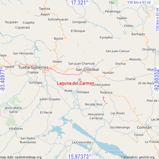
Laguna del Carmen GPS coordinates[2]
16° 38' 54.78" North, 92° 42' 23.904" West
| Map corner | latitude | longitude |
|---|---|---|
| Upper-left | 17.321°, | -93.40977° |
| Center: | 16.64855°, | -92.70664° |
| Lower-right: | 15.97373°, | -92.00352° |
| Map W x H: | 149.8×149.8 km | = 93.1×93.1mi |
| max Lat: | 32.7° ⇑93.3% North |
| Laguna del Carmen: | 16.64855° |
| min Lat: | ⇓6.7% South 14.53588° |
| min Long | Laguna del Carm | max Long |
| -117.105° | -92.70664° | -86.73105° |
| W 90.5%⇐ | ⇒9.5% E |
Elevation
Elevation of Laguna del Carmen is 1471 m = 4826 ft, and this is 217.3 m = 713 ft above average elevation for this country.
| Max E: |
3497 m = 11473 ft | 49.3% |
| Laguna del Carmen | 1471 m 4826 ft | |
| Avg. | 1253.7 m = 4113 ft | |
Min E: |
-1 m = -3 ft | 50.7% |
See also: Mexico elevation on elevation.city.
Geographical zone
Laguna del Carmen is located in North Torrid zone (between Equator and Tropic of Cancer). Distance of this Northern Tropic circle is 754.8 km =469 mi to North.| Distance of | km | miles | from Laguna del Carmen |
|---|---|---|---|
| North Pole | 8155.9 | 5067.8 | to North |
| Arctic Circle | 5550 | 3448.6 | to North |
| Tropic Cancer | 754.8 | 469 | to North |
| Equator | 1851.1 | 1150.2 | to South |


Nearby cities:
15 places around Laguna del Carmen: (largest is in red/bold)
• Apas
11.5 km =7.1 mi,  306°
306°
• Bochojbo Alto
9.8 km =6.1 mi,  353°
353°
• Chiapilla
8.9 km =5.5 mi,  189°
189°
• El Pig
11.1 km =6.9 mi,  326°
326°
• Francisco Villa
7.1 km =4.4 mi,  154°
154°
• Jech Chentic
9.7 km =6 mi,  339°
339°
• Jechtoch
8.6 km =5.3 mi, 351°
• Nachig
9.3 km =5.8 mi, 347°
• Pasté
7.2 km =4.5 mi, 329°
• San Cristóbal de las Casas
11.6 km =7.2 mi,  36°
36°
• San José Buenavista
3.9 km =2.4 mi,  221°
221°
• San Lucas
4.3 km =2.7 mi,  196°
196°
• Shulvo
8.7 km =5.4 mi, 340°
• Yalentay (San Joaquín)
11 km =6.8 mi, 331°
• Zacualpa Ecatepec
6.6 km =4.1 mi,  9°
9°
Sources, notices
• [Note1] Compared only with cities in Mexico existing in our database
• [Src1] Map data: © OpenStreetMap contributors (CC-BY-SA)
• [Src2] Other city data from geonames.org with taken over terms of usage.
• [Src3] Geographical zone / Annual Mean Temperature by Robert A. Rohde @ Wikipedia
