Chan Cenote geodata
Chan Cenote (Yucatán) is a populated place; located in Mexico in America/Merida (GMT-6) time zone. With population of 2,225 people, there are 3943 cities with bigger population in this country. Compared to other cities in Mexico, 76.4% of cities are located further ↓South; 99.8% of cities are located further ←West and 89.7% of cities have higher elevation than Chan Cenote. Note1


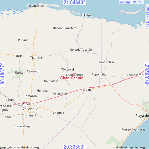
Chan Cenote GPS coordinates[2]
20° 59' 29.112" North, 87° 47' 8.304" West
| Map corner | latitude | longitude |
|---|---|---|
| Upper-left | 21.64643°, | -88.48877° |
| Center: | 20.99142°, | -87.78564° |
| Lower-right: | 20.33353°, | -87.08252° |
| Map W x H: | 146×146 km | = 90.7×90.7mi |
| max Lat: | 32.7° ⇑23.6% North |
| Chan Cenote: | 20.99142° |
| min Lat: | ⇓76.4% South 14.53588° |
| min Long | Chan Cenote | max Long |
| -117.105° | -87.78564° | -86.73105° |
| W 99.8%⇐ | ⇒0.2% E |
Elevation
Elevation of Chan Cenote is 25 m = 82 ft, and this is 1228.7 m = 4031 ft below average elevation for this country.
| Max E: |
3497 m = 11473 ft | 89.7% |
| Avg. | 1253.7 m = 4113 ft | |
| Chan Cenote | 25 m = 82 ft | |
Min E: |
-1 m = -3 ft | 10.3% |
See also: Mexico elevation on elevation.city.
Geographical zone
Chan Cenote is located in North Torrid zone (between Equator and Tropic of Cancer). Distance of this Northern Tropic circle is 271.9 km =169 mi to North.| Distance of | km | miles | from Chan Cenote |
|---|---|---|---|
| North Pole | 7673 | 4767.8 | to North |
| Arctic Circle | 5067.1 | 3148.5 | to North |
| Tropic Cancer | 271.9 | 169 | to North |
| Equator | 2334 | 1450.3 | to South |


Nearby cities:
15 places around Chan Cenote: (largest is in red/bold)
• Chechmil
30.6 km =19 mi,  217°
217°
• Cocoyol
22.5 km =14 mi,  170°
170°
• Colonia Yucatán
25.5 km =15.8 mi,  14°
14°
• Dzalbay
32.8 km =20.4 mi,  237°
237°
• El Cedral
24.8 km =15.4 mi,  100°
100°
• El Ideal
27.9 km =17.3 mi,  116°
116°
• Ignacio Zaragoza
29.7 km =18.5 mi,  114°
114°
• Kuxeb
17.2 km =10.7 mi,  210°
210°
• Nuevo Xcán
23.3 km =14.5 mi,  125°
125°
• Popolnah
23.1 km =14.4 mi,  89°
89°
• Sucopó
33.1 km =20.6 mi,  304°
304°
• Tixcancal
8.3 km =5.2 mi,  306°
306°
• Vicente Guerrero
30.5 km =19 mi, 91°
• X-Cán
19.2 km =11.9 mi,  140°
140°
• Xmuquel
11.9 km =7.4 mi, 207°
Sources, notices
• [Note1] Compared only with cities in Mexico existing in our database
• [Src1] Map data: © OpenStreetMap contributors (CC-BY-SA)
• [Src2] Other city data from geonames.org with taken over terms of usage.
• [Src3] Geographical zone / Annual Mean Temperature by Robert A. Rohde @ Wikipedia
