El Carrizo geodata
El Carrizo (Oaxaca) is a populated place; located in Mexico in America/Mexico_City (GMT-6) time zone. With population of 1,723 people, there are 5036 cities with bigger population in this country. Compared to other cities in Mexico, 96% of cities are located further ↑North; 63.2% of cities are located further ←West and 80.9% of cities have higher elevation than El Carrizo. Note1


El Carrizo GPS coordinates[2]
16° 15' 16.308" North, 98° 1' 50.88" West
| Map corner | latitude | longitude |
|---|---|---|
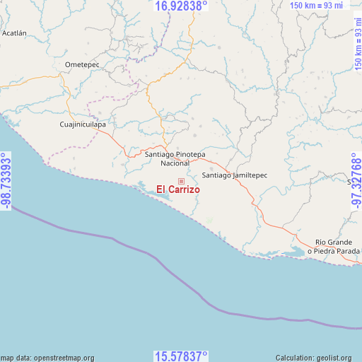
| Upper-left | 16.92838°, | -98.73393° |
| Center: | 16.25453°, | -98.0308° |
| Lower-right: | 15.57837°, | -97.32768° |
| Map W x H: | 150.1×150.1 km | = 93.3×93.3mi |
| max Lat: | 32.7° ⇑96% North |
| El Carrizo: | 16.25453° |
| min Lat: | ⇓4% South 14.53588° |
| min Long | El Carrizo | max Long |
| -117.105° | -98.0308° | -86.73105° |
| W 63.2%⇐ | ⇒36.8% E |
Elevation
Elevation of El Carrizo is 83 m = 272 ft, and this is 1170.7 m = 3841 ft below average elevation for this country.
| Max E: |
3497 m = 11473 ft | 80.9% |
| Avg. | 1253.7 m = 4113 ft | |
| El Carrizo | 83 m = 272 ft | |
Min E: |
-1 m = -3 ft | 19.1% |
See also: Mexico elevation on elevation.city.
Geographical zone
El Carrizo is located in North Torrid zone (between Equator and Tropic of Cancer). Distance of this Northern Tropic circle is 798.6 km =496.2 mi to North.| Distance of | km | miles | from El Carrizo |
|---|---|---|---|
| North Pole | 8199.7 | 5095.1 | to North |
| Arctic Circle | 5593.8 | 3475.8 | to North |
| Tropic Cancer | 798.6 | 496.2 | to North |
| Equator | 1807.3 | 1123 | to South |


Nearby cities:
15 places around El Carrizo: (largest is in red/bold)
• Cerro de la Esperanza
7.2 km =4.5 mi,  129°
129°
• Collantes
9.7 km =6 mi,  139°
139°
• Corralero
17 km =10.6 mi,  263°
263°
• Cruz del Itacuán
3.7 km =2.3 mi,  10°
10°
• Fraccionamiento San Isidro
12.6 km =7.8 mi,  342°
342°
• José María Morelos
12.1 km =7.5 mi,  117°
117°
• Mancuernas
17.2 km =10.7 mi,  330°
330°
• Paso del Jiote
8.7 km =5.4 mi, 119°
• Piedra Blanca
3.7 km =2.3 mi,  79°
79°
• Pinotepa Nacional
9.8 km =6.1 mi,  346°
346°
• Rancho Viejo
11.9 km =7.4 mi,  36°
36°
• San Andrés Huaxpaltepec
14.8 km =9.2 mi,  55°
55°
• Santa María Chico Ometepec
11.2 km =7 mi, 142°
• Santa María Huazolotitlán
13.7 km =8.5 mi,  66°
66°
• Santa María Jicaltepec
13.9 km =8.6 mi, 354°
Sources, notices
• [Note1] Compared only with cities in Mexico existing in our database
• [Src1] Map data: © OpenStreetMap contributors (CC-BY-SA)
• [Src2] Other city data from geonames.org with taken over terms of usage.
• [Src3] Geographical zone / Annual Mean Temperature by Robert A. Rohde @ Wikipedia
