Buenavista geodata
Buenavista (Oaxaca) is a populated place; located in Mexico in America/Mexico_City (GMT-6) time zone. With population of 913 people, there are 9556 cities with bigger population in this country. Compared to other cities in Mexico, 93.4% of cities are located further ↑North; 61.4% of cities are located further ←West and 69.8% of cities have higher elevation than Buenavista. Note1


Buenavista GPS coordinates[2]
16° 38' 10.86" North, 98° 11' 34.836" West
| Map corner | latitude | longitude |
|---|---|---|
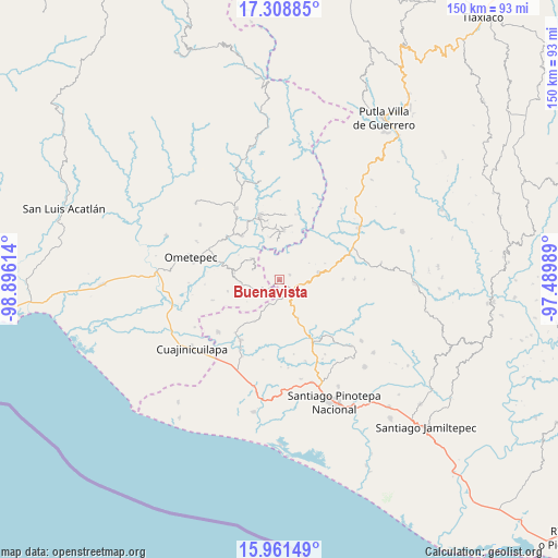
| Upper-left | 17.30885°, | -98.89614° |
| Center: | 16.63635°, | -98.19301° |
| Lower-right: | 15.96149°, | -97.48989° |
| Map W x H: | 149.8×149.8 km | = 93.1×93.1mi |
| max Lat: | 32.7° ⇑93.4% North |
| Buenavista: | 16.63635° |
| min Lat: | ⇓6.6% South 14.53588° |
| min Long | Buenavista | max Long |
| -117.105° | -98.19301° | -86.73105° |
| W 61.4%⇐ | ⇒38.6% E |
Elevation
Elevation of Buenavista is 427 m = 1401 ft, and this is 826.7 m = 2712 ft below average elevation for this country.
| Max E: |
3497 m = 11473 ft | 69.8% |
| Avg. | 1253.7 m = 4113 ft | |
| Buenavista | 427 m = 1401 ft | |
Min E: |
-1 m = -3 ft | 30.2% |
See also: Mexico elevation on elevation.city.
Geographical zone
Buenavista is located in North Torrid zone (between Equator and Tropic of Cancer). Distance of this Northern Tropic circle is 756.1 km =469.8 mi to North.| Distance of | km | miles | from Buenavista |
|---|---|---|---|
| North Pole | 8157.3 | 5068.7 | to North |
| Arctic Circle | 5551.4 | 3449.5 | to North |
| Tropic Cancer | 756.1 | 469.8 | to North |
| Equator | 1849.8 | 1149.4 | to South |


Nearby cities:
15 places around Buenavista: (largest is in red/bold)
• Arroyo Gente
10.4 km =6.5 mi,  357°
357°
• Camotinchan
11.3 km =7 mi,  139°
139°
• Huajintepec
4.9 km =3 mi,  233°
233°
• Huixtepec
12 km =7.5 mi,  279°
279°
• La Concepción
7.6 km =4.7 mi,  290°
290°
• La Guadalupe
9.4 km =5.8 mi,  308°
308°
• Los Liros
11.8 km =7.3 mi,  347°
347°
• Mártires de Tacubaya
12.7 km =7.9 mi,  210°
210°
• Pie de la Cuesta
7.3 km =4.5 mi,  103°
103°
• San Antonio Ocotlán
3.2 km =2 mi,  63°
63°
• San Juan Cacahuatepec
4.7 km =2.9 mi,  120°
120°
• San Pedro Amuzgos
11 km =6.8 mi,  79°
79°
• San Sebastián Ixcapa
11.3 km =7 mi,  153°
153°
• Sayultepec
8.1 km =5 mi, 123°
• Vista Hermosa
11.3 km =7 mi,  170°
170°
Sources, notices
• [Note1] Compared only with cities in Mexico existing in our database
• [Src1] Map data: © OpenStreetMap contributors (CC-BY-SA)
• [Src2] Other city data from geonames.org with taken over terms of usage.
• [Src3] Geographical zone / Annual Mean Temperature by Robert A. Rohde @ Wikipedia
