Camotinchan geodata
Camotinchan (Oaxaca) is a populated place; located in Mexico in America/Mexico_City (GMT-6) time zone. With population of 1,035 people, there are 8423 cities with bigger population in this country. Compared to other cities in Mexico, 94% of cities are located further ↑North; 62.2% of cities are located further ←West and 75.7% of cities have higher elevation than Camotinchan. Note1


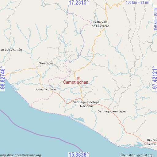
Camotinchan GPS coordinates[2]
16° 33' 31.428" North, 98° 7' 27.588" West
| Map corner | latitude | longitude |
|---|---|---|
| Upper-left | 17.2315°, | -98.82746° |
| Center: | 16.55873°, | -98.12433° |
| Lower-right: | 15.8836°, | -97.42121° |
| Map W x H: | 149.9×149.9 km | = 93.1×93.1mi |
| max Lat: | 32.7° ⇑94% North |
| Camotinchan: | 16.55873° |
| min Lat: | ⇓6% South 14.53588° |
| min Long | Camotinchan | max Long |
| -117.105° | -98.12433° | -86.73105° |
| W 62.2%⇐ | ⇒37.8% E |
Elevation
Elevation of Camotinchan is 200 m = 656 ft, and this is 1053.7 m = 3457 ft below average elevation for this country.
| Max E: |
3497 m = 11473 ft | 75.7% |
| Avg. | 1253.7 m = 4113 ft | |
| Camotinchan | 200 m = 656 ft | |
Min E: |
-1 m = -3 ft | 24.3% |
See also: Mexico elevation on elevation.city.
Geographical zone
Camotinchan is located in North Torrid zone (between Equator and Tropic of Cancer). Distance of this Northern Tropic circle is 764.8 km =475.2 mi to North.| Distance of | km | miles | from Camotinchan |
|---|---|---|---|
| North Pole | 8165.9 | 5074.1 | to North |
| Arctic Circle | 5560 | 3454.8 | to North |
| Tropic Cancer | 764.8 | 475.2 | to North |
| Equator | 1841.2 | 1144.1 | to South |


Nearby cities:
15 places around Camotinchan: (largest is in red/bold)
• Buenavista
11.3 km =7 mi,  319°
319°
• Chuparrosa
13.6 km =8.5 mi,  143°
143°
• Huajintepec
12.6 km =7.8 mi,  296°
296°
• Mártires de Tacubaya
13.9 km =8.6 mi,  260°
260°
• Pie de la Cuesta
7 km =4.3 mi,  358°
358°
• San Antonio Ocotlán
11 km =6.8 mi,  336°
336°
• San Antonio Tepetlapa
6.5 km =4 mi,  104°
104°
• San Juan Cacahuatepec
7.1 km =4.4 mi,  332°
332°
• San Pedro Amuzgos
11.1 km =6.9 mi,  18°
18°
• San Pedro Tulixtlahuaca
9.8 km =6.1 mi, 102°
• San Sebastián Ixcapa
2.6 km =1.6 mi,  235°
235°
• Santa María Ipalapa
13.4 km =8.3 mi,  47°
47°
• Sayultepec
4.2 km =2.6 mi,  351°
351°
• Vista Hermosa
6.1 km =3.8 mi,  245°
245°
• Yutandayoo
12.4 km =7.7 mi,  155°
155°
Sources, notices
• [Note1] Compared only with cities in Mexico existing in our database
• [Src1] Map data: © OpenStreetMap contributors (CC-BY-SA)
• [Src2] Other city data from geonames.org with taken over terms of usage.
• [Src3] Geographical zone / Annual Mean Temperature by Robert A. Rohde @ Wikipedia
