Benito Juárez geodata
Benito Juárez (Oaxaca) is a populated place; located in Mexico in America/Mexico_City (GMT-6) time zone. With population of 1,305 people, there are 6645 cities with bigger population in this country. Compared to other cities in Mexico, 97.6% of cities are located further ↑North; 80.7% of cities are located further ←West and 71.7% of cities have higher elevation than Benito Juárez. Note1


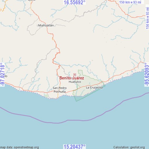
Benito Juárez GPS coordinates[2]
15° 52' 54.408" North, 96° 19' 26.58" West
| Map corner | latitude | longitude |
|---|---|---|
| Upper-left | 16.55692°, | -97.02718° |
| Center: | 15.88178°, | -96.32405° |
| Lower-right: | 15.20437°, | -95.62093° |
| Map W x H: | 150.4×150.4 km | = 93.5×93.5mi |
| max Lat: | 32.7° ⇑97.6% North |
| Benito Juárez: | 15.88178° |
| min Lat: | ⇓2.4% South 14.53588° |
| min Long | Benito Juárez | max Long |
| -117.105° | -96.32405° | -86.73105° |
| W 80.7%⇐ | ⇒19.3% E |
Elevation
Elevation of Benito Juárez is 339 m = 1112 ft, and this is 914.7 m = 3001 ft below average elevation for this country.
| Max E: |
3497 m = 11473 ft | 71.7% |
| Avg. | 1253.7 m = 4113 ft | |
| Benito Juárez | 339 m = 1112 ft | |
Min E: |
-1 m = -3 ft | 28.3% |
See also: Mexico elevation on elevation.city.
Geographical zone
Benito Juárez is located in North Torrid zone (between Equator and Tropic of Cancer). Distance of this Northern Tropic circle is 840 km =522 mi to North.| Distance of | km | miles | from Benito Juárez |
|---|---|---|---|
| North Pole | 8241.2 | 5120.8 | to North |
| Arctic Circle | 5635.3 | 3501.6 | to North |
| Tropic Cancer | 840 | 522 | to North |
| Equator | 1765.9 | 1097.3 | to South |


Nearby cities:
15 places around Benito Juárez: (largest is in red/bold)
• Aguaje el Zapote
14.6 km =9.1 mi,  152°
152°
• Cuapinolito (Azulillo)
6.7 km =4.2 mi,  174°
174°
• La Erradura
5.4 km =3.4 mi,  192°
192°
• Los Naranjos Esquipulas
18.2 km =11.3 mi,  307°
307°
• Paso Ancho
4.4 km =2.7 mi, 168°
• Pluma Hidalgo
11.3 km =7 mi,  296°
296°
• San Isidro Apango
8.8 km =5.5 mi,  204°
204°
• San José Chacalapa
16 km =9.9 mi,  248°
248°
• San Mateo Piñas
13.2 km =8.2 mi,  355°
355°
• San Miguel Figueroa
13.6 km =8.5 mi,  218°
218°
• San Miguel del Puerto
16.5 km =10.3 mi,  74°
74°
• Santa María Huatulco
5.5 km =3.4 mi,  176°
176°
• Santa María Limón
10.1 km =6.3 mi,  208°
208°
• Santiago Xanica
17.8 km =11.1 mi,  36°
36°
• Toltepec
13.9 km =8.6 mi,  270°
270°
Sources, notices
• [Note1] Compared only with cities in Mexico existing in our database
• [Src1] Map data: © OpenStreetMap contributors (CC-BY-SA)
• [Src2] Other city data from geonames.org with taken over terms of usage.
• [Src3] Geographical zone / Annual Mean Temperature by Robert A. Rohde @ Wikipedia
